
Southern BC Rockies
Overview
Print Page
Route - 2778 km / 1726 mi
| Day | Location | Distance | Duration |
|---|---|---|---|
| 01 | Vancouver to Victoria | 69 km / 43 mi | Approx. 2 hours |
| 02 | Victoria | ||
| 03 | Victoria to Tofino | 316 km / 196 mi | Approx. 4 hours 27 minutes |
| 04 | Tofino | ||
| 05 | Tofino to Whistler | 304 km / 189 mi | Approx. 6 hours 25 minutes (via ferry) |
| 06 | Whistler | ||
| 07 | Whistler to Sun Peaks | 360 km / 224 mi | Approx. 4 hours 35 minutes |
| 08 | Sun Peaks to Jasper | 455 km / 283 mi | Approx. 4 hours 56 minutes |
| 09 | Jasper | ||
| 10 | Jasper to Banff | 293 km / 182 mi | Approx. 3 hours 35 minutes |
| 11 | Banff | ||
| 12 | Banff to Revelstoke | 287 km / 178 mi | Approx. 3 hours 16 minutes |
| 13 | Revelstoke to Peachland | 229 km / 142 mi | Approx. 2 hours 52 minutes |
| 14 | Peachland | ||
| 15 | Peachland to Hope | 285 km / 177 mi | Approx. 2 hours 16 minutes |
| 16 | Hope to Vancouver | 180 km / 112 mi | Approx. 2 hours |

Vancouver to Victoria

Victoria

Victoria to Tofino

Tofino

Tofino to Whistler

Whistler

Whistler to Sun Peaks

Sun Peaks to Jasper

Jasper
Jasper to Banff

Banff

Banff to Revelstoke

Revelstoke to Peachland

Peachland

Peachland to Hope

Hope to Vancouver
Trip Details
Arriving on the Island, make Sidney your first stop and enjoy this seaside town before finding a place to stay for the night. Make sure to download our CanaDream app to take advantage of partner discounts.
CanaDream Club Partners:
Other suggestions include whale watching, a visit to Craigdarroch Castle, sailing or sea kayaking, a visit to the Royal BC Museum, a stroll along Fort Street to shop for antiques or a relaxing walk around the Inner Harbor. A visit to Beacon Hill Park is also a great way to spend some time. Make sure to check out our CanaDream app for partner discounts on activities, places to stay and experiences.
CanaDream Club Partners:
Taking into account the five-hour drive to Tofino, you may still find time to squeeze in an extra activity or two along the way. Part-way up the west side of the island, you will come to a town named Chemainus. This is a pretty little seaside town with different murals painted on the sides of many downtown buildings. These murals depict the town’s corporate history and community spirit.
Branching off the Trans Canada Highway onto Highway 4A, just north of Nanaimo, you will be on your way to Port Alberni and Tofino. Stop for lunch at Coombs to see the goats that graze on the roof of a local cafe/bakery. Before reaching Port Alberni, the highway passes through MacMillan Provincial Park where you can walk among huge old-growth rain forest at Cathedral Grove, with trees up to two to three metres thick. This is a fantastic place to stop!
From Port Alberni to Tofino, the highway narrows. Traffic usually slows down somewhat through this section to accommodate the winding, mountainous roads.
CanaDream Club Partners:
- Cedar Springs Ranch
- Malahat Mountain Meadows
- Country Maples RV Resort (Holiday Trails) south of Chemainus
- Mountainaire Campground & RV Park
- Whiskey Creek Campground
- Surf Grove Beachside Campground
- Tofino Resort + Marina
- West Coast Aquatic Safaris
Tofino is an incredible playground. From whale watching, kayaking tours and chartered fishing expeditions to hiking and golfing, there’s an adventure for everyone. It’s also known as a surfer’s paradise.
The spectacular, magical island town is home to artists, incredible food and also the perfect place to relax. You may want to extend your time here to really soak in and enjoy the island vibes.
CanaDream Club Partners:
A return trip down the winding road to Port Alberni is the only way back to the east and more populated side of the island. You have a fairly long drive ahead of you so we suggest you start out fairly early. We recommend you make a reservation for the ferry in Nanaimo at Departure Bay to Horseshoe Bay. Or, split this journey into two days.
The drive to Whistler is beautiful, and the Sea to Sky Highway is notorious for its scenic mountainous roads. Hugging the coast all the way to the top of Howe Sound, then heading inland, the Sea to Sky Highway has a number of scenic viewpoints where you can stop and safely enjoy the views.
Stop at Shannon Falls Provincial Park to view the magnificent falls. Shannon Falls are the third highest in BC at 335 metres above the Sea to Sky Highway. And, just 11km (7 miles) south of Whistler, is Brandywine Falls Provincial Park. Here a spectacular 70 metre waterfall is best seen from the viewpoint which also presents some marvellous views of Daisy Lake and the surrounding mountains.
CanaDream Club Partners:
- Britannia Mine Museum
- Sea to Sky Gondola
- Canadian Outback Rafting
- MTN Fun Basecamp
- Paradise Valley Campground
- Whistler RV Park and Campground
- Backroads Whistler
- Ziptrek Ecotours Inc.
- Canadian Wilderness Adventure
- Squamish Lil’wat Cultural Centre
- Riverside Resort Park
- Audain Art Museum
- Blackcomb Helicopters
Whistler has lots to offer the summer visitor. Along with scenic lakes to hike around, a gondola that offers memorable views and a fantastic mountain bike park, there are four championship golf courses to choose from.
Go horseback riding in the mountains, or race down steep, jagged trails on a mountain bike. How about taking a canoe trip down the "River of Golden Dreams"? Ride an ATV to the Crystal Hut perched atop Blackcomb Mountain and enjoy a salmon bake or go white water rafting through pulsing rapids on the Upper Lillooet River. Check out your CanaDream app to discover partner discounts available to you.
The "Peak 2 Peak" gondola is a must-do in Whistler. The journey between Whistler and Blackcomb mountains provides a 360-degree window into the alpine environment of the two mountains, their surrounding peaks, and changing seasons. Ride one of the glass bottom cars to get a true sense of what lies below you as well as all around you.
CanaDream Club Partners:
Highway 99 from Whistler to Sun Peaks is not as busy as some in British Columbia, making the drive a leisurely, beautiful one. You will be driving in somewhat isolated areas, with lots of lakes, rivers, forest, and wildlife, but not too many towns or gas stations. Be sure that your gas tank is full before leaving Pemberton. The Duffy Lake Road is a beautiful, winding drive.
Sun Peaks is just northeast of Kamloops. When you arrive in Sun Peaks, you will find another challenging golf course to conquer. The spot reserved for RVs is just across the road from the entrance to the golf course. There are no hook-ups in this lot, but parking here is free of charge. Just about every day of the summer, there is a special activity scheduled. There are first-come, first-served camping amenities at the resort with picnic tables at each site and water nearby. No electrical hookup is available. Look for the sign at parking lot #4 adjacent to the Sports Centre.
Overnight at Sun Peaks Resort.
CanaDream Club Partners:
On this leg of the journey, be prepared to see some wildlife beside the highway. The elevation gain seems moderate, but the scenery is varied and majestic. This is another route with few gas stations. There are not that many services to count on between Clearwater and Blue River and then little available until Valemont.
Mount Robson Provincial Park is a great place to take a break and stretch your legs before arriving in Jasper. You can easily walk down along the river bordering the parking lot. For the more adventurous, there are hiking trails available with more information on routes and markers available at the Provincial Park parking lot.
There are places to rent canoes and lots of venues perfect for a day hike. Sunwapta Falls are thrilling to see as the power of the water cascading down the rocky cliffs is deafening as well as humbling. As well, Maligne Canyon is a spectacular sight. For fishing and boat touring, a visit to Maligne Lake and Spirit Island is an enjoyable day out.
The Jasper SkyTram offers a terrific view of Jasper and beyond. From the top of Whistlers Mountain you can see six mountain ranges. Consider a 60km drive out to Miette Hot Springs tonight for a relaxing soak amidst majestic mountain scenery. Wildlife on this route is virtually guaranteed - whether it be big-horn sheep, goats, elk or bears. Check out the CanaDream web app for discounts on activities while you’re in Jasper.
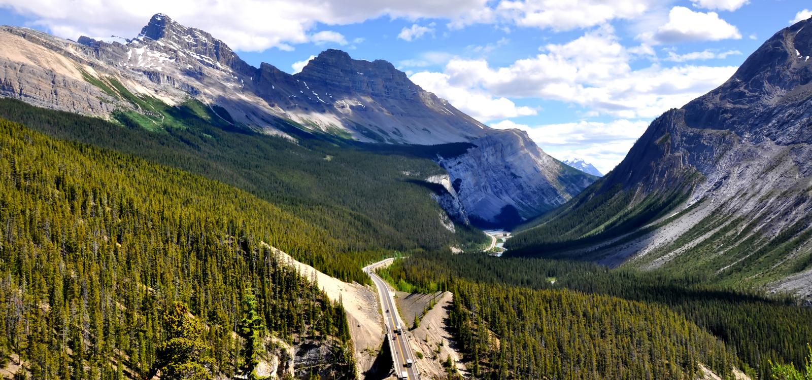
There are a number of smaller National Park campgrounds dotted along the Icefields Parkway should you decide to spend more time hiking the trails along this spectacular stretch of road.
As you come around the bend in the road near Bow Summit, the highest point on the Icefields Parkway, you will see a spectacular vista. Then, as you round the turn, you begin a slow descent to the valley below. Peyto Lake is another worthy stop along the way. This lake is south of the Columbia Icefields and close to the Bow Glacier lookout.
The Icefields Parkway ends in the picturesque village of Lake Louise. Stop and explore the beauty of the emerald lakes here before travelling on to Banff.
CanaDream Club Partners:
- Canadian Rockies Rafting
- Discover Banff Tours
- Banff Canoe Club
- Banff Jasper Collection by Pursuit
- Canadian Rockies Hot Springs
Visit the Whyte Museum of the Rockies, which holds a very large collection of mountain art by a wide variety of artists who either lived in the Park or spent time working in the area.
Hike east along the Bow River to the Hoodoos(eroded rock formations by the river’s edge), ride or hike up Sulphur Mountain and take the gondola down, then take a soothing dip in the Banff Hot Springs at the base of Sulphur Mountain. Or, go to the west side of town and rent a canoe and paddle northwest along the creek to the Vermillion Lakes. Enjoy.
CanaDream Club Partners:
- Canadian Rockies Rafting
- Discover Banff Tours
- Banff Canoe Club
- CMH Heli-Skiing & Summer Adventures
- SkiBig3
Arriving in Revelstoke, this small mountain town has a beautiful and walkable downtown centre with ski and bike shops, inviting cafes and places for a delicious craft brew. Depending on the time of year you’re visiting, this is an epic place to spend your time adventuring – hiking, skiing, biking, heli-tours and snowmobiling are all available to you. With plenty of guiding operations and local expertise, check out our CanaDream web app to take advantage of any partner discounts while you’re here.
CanaDream Club Partners:
- Revelstoke Mountain Resort
- Natural Escapes Kayaking
- Apex Rafting Company
- Great Canadian Tours
- Golden Golf Club & RV Resort
- Williamson Lake Campground
- Campers Haven RV & Tent Park
- Rockies Heli Canada
- Wild Water Adventures
- Kootenay River Runners
- Canyon Hot Springs Resort RV Resort
- Revelstoke RV & Cabin Resort
- CMH Heli Skiing
- PlayWest Mountain Experiences
As you go further south from Vernon, there are expansive fruit orchards and wineries along the route to Peachland. All during the summer, there are many varieties of fruit for sale from open-air stalls along the highways. The cherries, peaches and pears have that fresh-picked flavour.
CanaDream Club Partners:
- 3 Valley Gap Heritage Tours
- Crazy Creek Resort
- Silver Star Mountain Resort
- The Orchard RV Retreat
- Wood Lake RV Park & Marina
- Canadian Wildlife Museum
- Holiday Park Resort
- Okanagan Wine Tours
- Myra Canyon Bicycle Rentals
- Revelstoke Mountain Resort
- Shuswap Falls RV Resort
CanaDream Club Partners:
Turn west on Highway 3 at this point and carry on to Princeton. Here you will find a very unique museum that displays treasures and trinkets from the history of the area. Continuing on Highway 3, you will follow a gradual descent down through Manning Provincial Park. This Park is in a great location for an afternoon refreshment break.
While in the Park, you are in the shadow of the Cascade Mountains, just a few kilometres north of the border with the United States
Making time for a few breaks along the way, this route brings you to Hope by late afternoon.
CanaDream Club Partners:
From the Highway, there is a turn-off that takes you into a viewing area of the Bridal Veil Falls — a very high and narrow ribbon of water that falls in a turbulent mist, giving the observer the impression of a bridal veil.
Fort Langley, on the south side of the Fraser River, is a Provincial Historic Site. As you drive along the Fraser River Delta, you have a choice to cross to the north of the River on your return to Vancouver. This route takes you through smaller towns and verdant countryside instead of the Trans Canada which gets very busy at this point.
From the Fraser Delta and these outlying towns, you have just a short drive ahead of you, bringing you to the end of your adventure at our CanaDream Vancouver Station.
CanaDream Club Partners:
- Pacific Border RV Park
- Peace Arch RV Park
- Burnaby Cariboo R.V. Park
- Vancouver Whale Watch
- Quality Hotel Airport
- Landsea Tours & Adventures
- Sandman Vancouver City Centre
- Vancouver Lookout
- Cycle City Tours and Rentals
- Harbour Cruises Ltd.
- Stanley Park Horse-Drawn Tours
- Vancouver Aquarium
- Talaysay Tours
- Capilano River RV Park
- Capilano Suspension Bridge
- Grouse Mountain
- Bridal Falls Waterpark
- Sandman Hotel Vancouver Airport
- Sheraton Vancouver Airport Hotel
- Quality Inn & Suites Downtown Vancouver
- Seabreeze Adventures
- Vancouver Whale Watch
- Vancouver Foodie Tours


