October 2023
RVing the Dempster Highway
and Beyond
There's nothing like the satisfaction of ticking something off the bucket list. This adventure was a long time coming and definitely worth the wait! Driving the Dempster Highway and beyond to Tuktoyaktuk is an adventure like no other!
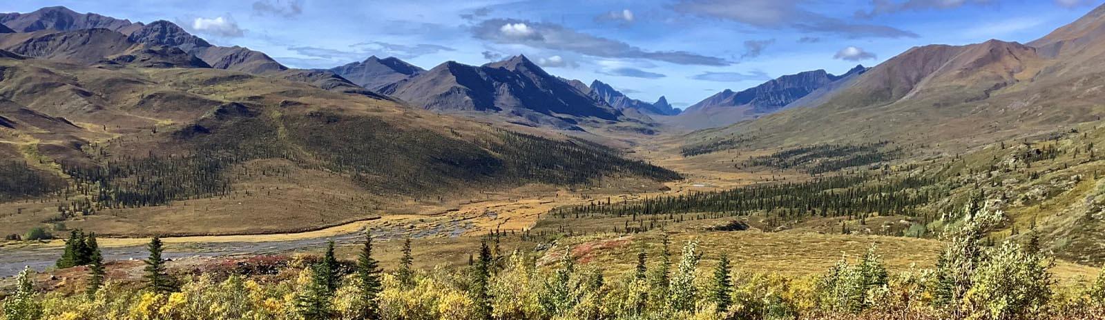
Along the Dempster Highway, we were presented with stunning views of mountains, valleys, and the vast expanse of the Arctic tundra. As we made our way to Tuktoyaktuk (Tuk), we traversed the iconic Inuvik to Tuktoyaktuk Highway, which opened in 2017, connecting these two historic communities. En route, we spotted foxes, bears and a multitude of bird life, visited cultural landmarks, and immersed ourselves in the rich heritage of the region. Join us as we offer insights, tips and first-hand information about driving the Dempster and Tuk Highways in an RV.
Breathtaking landscapes, rugged terrain, and remote wilderness are just some of the special moments we experienced in this arctic region of Canada.
Where is the Dempster Highway and what is the best way to travel it?
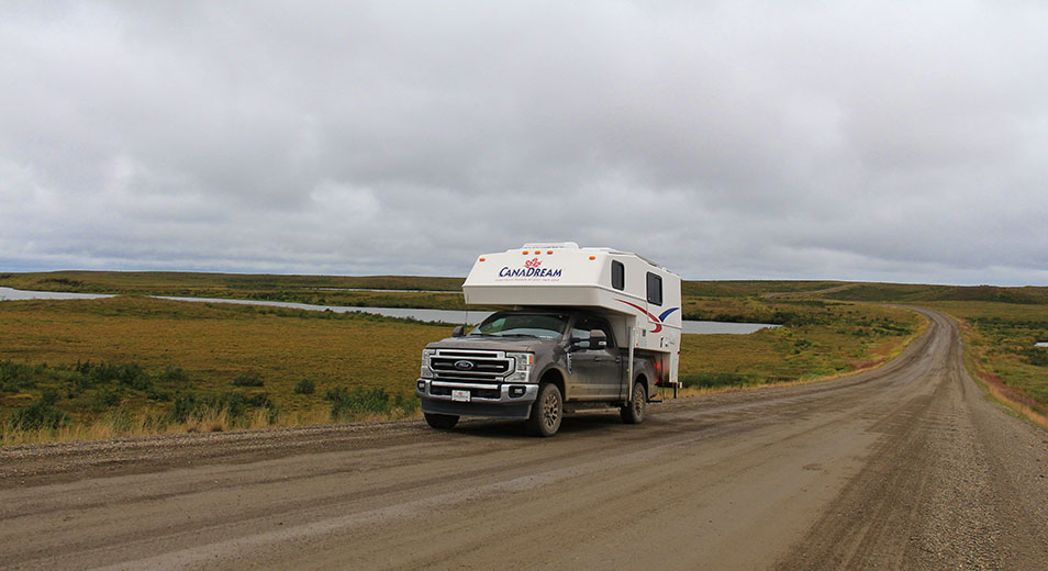
The Dempster Highway (known locally as 'the Dempster") is a 736km long road beginning 40km east of Dawson City, Yukon, continuing north of the Arctic Circle, and ending in the Northwest Territories town of Inuvik. Road conditions vary greatly, but essentially it's an unpaved road built from gravel, shale and clay. To say it can be 'bumpy' is an understatement.
There are few hotels and lodging places along the highway. You can stay in Eagle Plains, approx. 370km from the Dempster Turnoff, and from there, options are few unless you are camping. Reservations are essential if you are looking for hotel or inn type accommodation. Hands down, we'd say the most enjoyable way to travel the Dempster is in an RV, preferably a four-wheel-drive high wheel-based one. We opted to rent a TCA truck and camper from CanaDream in Whitehorse and have absolutely no regrets, particularly as we met and talked with people in low cars and large class C RVs who found the road much more challenging than we did. Another bonus of the truck camper is that we were isolated from all the clattering from inside the RV. The roads aren't kind to anything in the camper - we often found our belongings (including the contents of the fridge on one occasion) all over the floor. Use tape if you need to to keep it from flying open!
The road is rough. Windshield damage and flat tires are common
How long does it take to drive the Dempster Highway?
Our advice - take your time. Theoretically, you can travel it in 12-14 hours but why would you? There is so much spectacular scenery on the way, along with opportunities to hike, that the minimum you should spend on this road is 2-3 days. It's probably going to take twice the time you think it will - we averaged just over 50km an hour so we ended up assuming that a 100km distance would take us at least 2 hours to cover. At times, this meant long days driving.
Does the Dempster Highway cross the Arctic Circle?
Yes! You'll cross the Arctic Circle at latitude 66°33' N. Make sure you stop at the signpost here for some great views and to take a selfie to prove you were there!
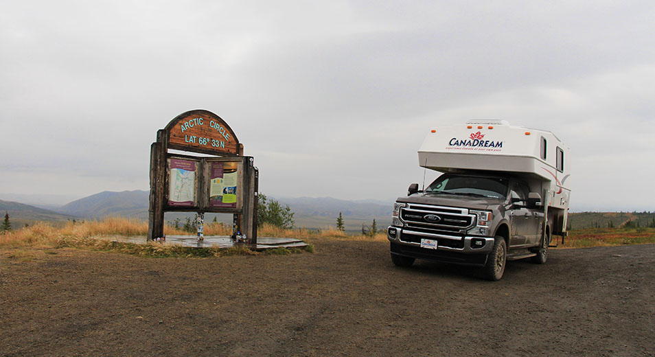
Arriving at the Arctic Circle sign
What sort of road conditions will I encounter on the Dempster Highway and the Inuvik to Tuktoyaktuk Highway?
That entirely depends on the weather! I think we encountered it all. Starting out with blue skies and wall to wall sunshine, we were optimistic the weather was going to be kind to us. Fortunately, we ended the day with only light dust on the vehicle. Two days later we had overnight rain, wetting down the dust but leaving light mud on the running boards and bottom half of the truck. And then the heavens opened and the light mud turned to brown, slushy, liquid mud, making the RV almost unrecognizable. Ceran wrap was our friend as we wrapped the mud-caked door handle so we wouldn't transfer the mud from our hands into the camper. Four-wheel drive was a bonus as the road became really slippery. Plan for the worst and be happy if it doesn't happen!
Mud covered our RV as the heavens opened and the ground became slippery
Potholes and construction are two of the most common things you'll encounter. The roads are built on permafrost and maintenance is ongoing. The highway is divided into sections where maintenance workers set up 'camps' along the highway to ensure the road is in the best possible condition. We experienced numerous delays awaiting pilot cars and soon realized that you can't be in a hurry to travel these roads. If you're wearing a FitBit or step tracker - the bumpy roads will record you as having done a lot of exercise. In my case, around 20,000 steps a day!
Regardless of the vehicle you decide to travel in, make sure your tires are in good condition before you set out. Carry at least one (preferably two) good spares with you - we were lucky not to have to use ours but many weren't. If you have the opportunity to take out windshield insurance, do it. You'll be sharing the road with semis and large vehicles, and windshield chips and cracks are common.
Can I travel the Dempster Highway year-round?
While the Dempster is a year-round road in most places, the complete road is impassable during the spring thaw and the fall freeze-over. The road crosses two rivers served by free ferries. In fall the road closes for approximately 6-8 weeks for the rivers to freeze and again for 3-5 weeks in the spring until the ice cover has thawed. In winter, the rivers are crossed by ice roads. If you're planning to drive the Dempster however, the best time to do it is from mid June to mid September. Bear in mind that during spring and summer months, mosquitos will be an issue for you. Bug repellent is a must. We were travelling in late August and they weren't that bad but we were still thankful for the bug spray. Think of the mozzies as part of the adventure!
When deciding the best time to travel the highway, think about what you want to see and do. Peak times are around the summer solstice when the sun never sets and during the Fall when the arctic tundra changes colour and takes your breath away. June through mid-August bring fairly warm temperatures while late August through September could be considered jacket weather.
Where can I camp along the Dempster Highway?
This is the good news! The Dempster Highway offers many options for both freedom and organized camping. On the 465km of Dempster highway in the Yukon Territory, you'll find three Yukon Government campgrounds. Cross the border into the Northwest Territories and you'll find another four, including a serviced campground in downtown Inuvik. While the Yukon Government campgrounds are basic with no services (pit toilets), many of the NWT campgrounds have flush toilets and showers. If you prefer to 'freedom' camp, this is possible on public land outside of Tombstone Territorial Park, provided there are no signs indicating that camping is not allowed. Government campgrounds in the Yukon are first-come, first-served. In peak travel times (including the fall colour season), it's advisable to plan your itinerary to arrive by mid afternoon to ensure you snag a camping spot. Campgrounds in the Northwest Territories are reservable if you are firm with your travel plans.
The Tombstone Campground is one of seven campgrounds along the Dempster Highway
Can I fill my freshwater tank and empty my holding tanks along this highway?
If you're planning to spend a number of days on the Dempster, you should be aware that we found no opportunities to empty our waste tanks between Dawson City and Inuvik. Before you leave these towns, ensure your tanks are empty and your freshwater tank is full. If you're travelling in a truck camper as we were, our black tank held only 13 US gallons so we used it sparingly and utilized campground toilets wherever possible. Fresh water fill is available at Eagle Plains.
Where can I get gas, diesel or propane along the Dempster Highway?
Fill up in either Dawson City or at the Dempster Corner cardlock station. After Dempster corner there are no gas stations for 370km. Fill up again in Eagle Plains, a roadside service area with a permanent population of 8 people. It's not really a town but you can gas up here, service your vehicle, get propane, buy small essentials and get a good meal. There's a place here to camp with electrical hookups and you can refill your freshwater tank. It's less than an hour from the Arctic Circle sign so a good place to overnight. Wi-Fi is available in the lobby and restaurant areas but there is no cellphone service. Coming back down the Dempster, make sure you have a full tank when you leave Inuvik. Fuel is also available in Fort McPherson.
If you have a CanaDream TCA, you'll leave with two full 9kg propane tanks. When one runs out, you should switch to the other and find a propane filling station. These are available only in Inuvik, Eagle Plains and Dawson City.
Is there cellphone service on the Dempster Highway?
There were small pockets of cellphone service on the highway near the few towns we came to but nothing you could rely on. We found ourselves travelling sometimes for a couple of hours without seeing another vehicle so keep in mind that help could be hard to find. We passed many crumbled vehicles in roadside ditches but acknowledge many had been there for a long time - given the isolation on this road, it's often not worth recovering them. We opted to rent a sat phone for the trip - we didn't need to use it but felt good about having this 'insurance' should anything have happened.
Where is Tuktoyaktuk and is it on the Arctic Ocean?
Tuktoyaktuk is an Inuvialuit hamlet on the shores of the Arctic Ocean in the far north of the Northwest Territories. It's the only arctic community in Canada connected to the rest of the country by public road and the furthest north you can drive in North America. Once called Port Brabant, Tuktoyaktuk, translated into English, means "resembling a caribou". The town has the historical distinction of being the first place in Canada to revert to a traditional Indigenous name. The end of the road sports a sign saying Arctic Ocean and the thing to do here is to 'dip your toes' in the Arctic.
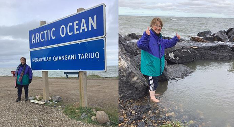
We made it to the Arctic Ocean. End of the Tuk road
What are the 'must see' places along the Dempster Highway?
For mile by mile in-depth information on travelling the Dempster Highway (and many other routes in the Yukon, Alaska and Northwest territories), you can't beat The Milepost, available for purchase online. If you just want to take in the highlights, here's our pick of stopping places.
Km 0. Everyone needs to stop here - if not to gas up before continuing north, to have your picture taken by the Dempster Highway sign.
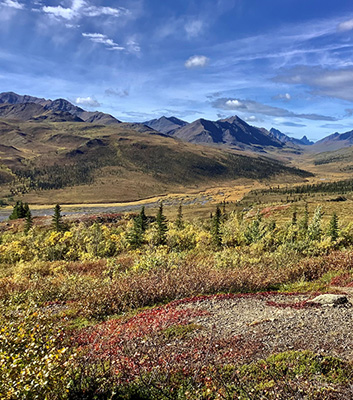
Km 71. Tombstone Territorial Park could be considered the 'crown jewel' of the Dempster. It's a place of stunning arctic tundra, abundant wildlife, First Nations culture and opportunities for hiking and back-country camping. Call in at the Interpretive Centre (open May to September) for information. The Tombstone Territorial Park Campground is close by. There are some easy short hikes here.
Km 74. Be sure to stop at the Tombstone Mountain Viewpoint for stunning views of the surrounding area. If you're travelling in the fall, the colours are breathtaking.
KM 158. The Chapman Lake Airstrip runs alongside the highway here. There are other abandoned gravel airstrips along the highway but the quirkiest of them all is the Wiley Aerodrome, around 22km north of Eagle Plains, where the airstrip is actually a small section of the highway itself. On our return trip, there was a small plane parked in the pull off area but we didn't get to see it land.
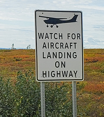
22km north of Eagle Plains, the Dempster Highway doubles as the airstrip for the Wiley Aerodrome.
KM 180. Red Creek. Here the hills and creeks are a rusty brown due to high levels of iron.
KM 260. Ogilvie Ridge Viewpoint. Great views of the tundra and mountains.
KM 360. Eagle Plains. Roadhouse with services.
KM 405.6. The Arctic Circle sign.
KM 465. Boundary between the Yukon and the NWT. It also marks a crossing of the Continental Divide. Between March and November the Northwest Territories is one hour ahead of the Yukon.
KM 539. Peel River Crossing. The first of the free ferry crossings on the Dempster. There's a nice NWT campground close by with hot showers and flush toilets but no sani-dump or water fill.
KM 550. Fort McPherson. A small hamlet in the traditional territory of the Teetl'it Gwich'in First Nation. Gas is available here.
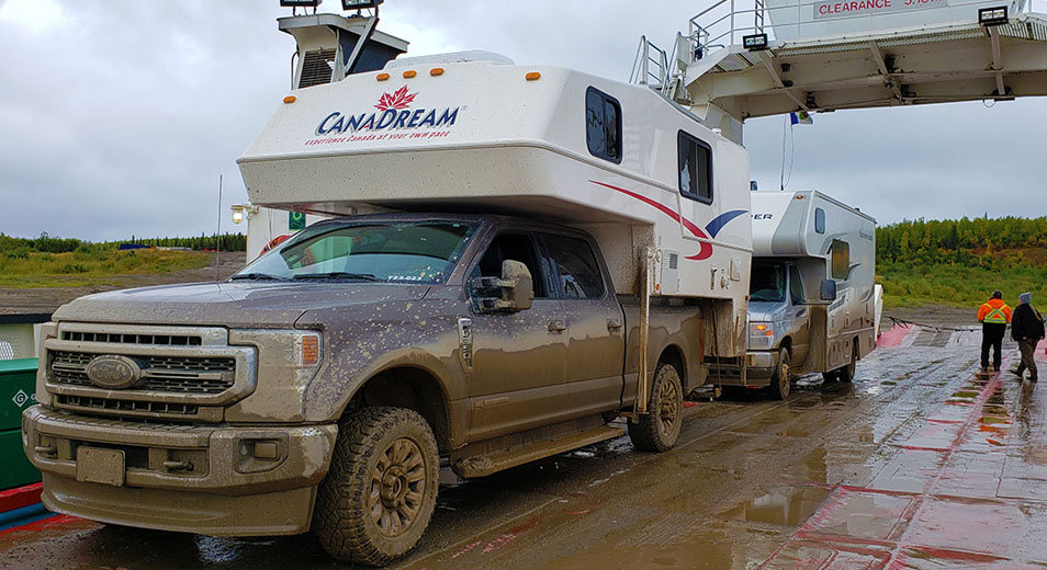
KM 608. Mackenzie River Crossing. A slightly longer ferry crossing across the Mackenzie River. This ferry also services Tsiigehtchic as required so you may experience a short wait here.
KM 736. Inuvik, and the end of the Dempster Highway. Between Mackenzie River Crossing and Inuvik, camping is available at Vadzaih Van Tshik and Jak Territorial Park Campgrounds but we'd recommend the Happy Valley campground in Inuvik itself if you are planning a stay here. Attractions include the Igloo Church, boat tours and a visit to Canada's northernmost greenhouse. Visit the Western Arctic Visitor Information Centre to view displays and get more information on things to do here. The people are friendly and want to share their culture. A brief conversation outside the supermarket with a Gwich'in native had me accompanying him to the local library to show me some of their culture and traditions. Super cool. Fun fact: Inuvik has a large satellite farm, the town being ideally positioned to track and receive data from polar-orbiting satellites.
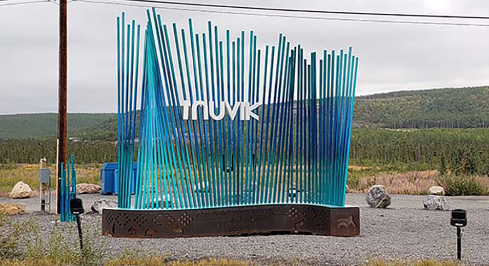
Inuvik at the top end of the Dempster Highway
While the Dempster Highway ends here, most people will want to continue on to Tuktoyaktuk which we did following our overnight stay at Happy Valley. This campground had a sani-dump, fresh water fill, showers and even laundry facilities. There was a truck wash nearby. Some would say there was no point in washing a camper that would just get dirty again but it was liberating to have no mud for at least a short time. We were never in any doubt that we wanted to continue on to Tuk and we weren't disappointed. There's nothing but great scenery along the bumpy road which is wide enough in most places to just stop to take photos. Tuktoyaktuk itself is an Inuvialuit hamlet on the edge of the Arctic Ocean. It's the gateway for exploring Pingo National Landmark, an area protecting eight nearby ice-dome hills (pingos). Many of the locals still hunt, fish and track, relying on caribou in the autumn, ducks and geese in the spring and autumn and fishing year round. Beluga whales can often be seen from land. Residents of Tuk occasionally see polar bears in early Spring as the ice thaws.
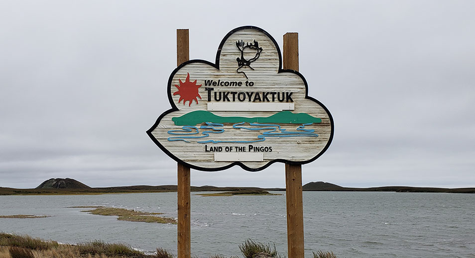
Pingos and the Tuktoyuktuk sign
For us, there were two main highlights. The only camping is at the Point, right on the shores of the Arctic Ocean. We drifted off to sleep with a view of the Arctic Ocean sign on one side and the sounds of crashing waves around us. Be sure to visit Grandma's Kitchen. At first glance it's a trailer serving take-out food, but the food is actually served in a building close-by with windows facing out over the ocean. On the evening we were there, we were eating our food when 'Grandma' came in to say she had to close for a couple of hours to go to Bingo! Such a laid-back lifestyle and so refreshing. And, of course, we did the obligatory dipping our feet in the Beaufort Sea portion of the Arctic Ocean.
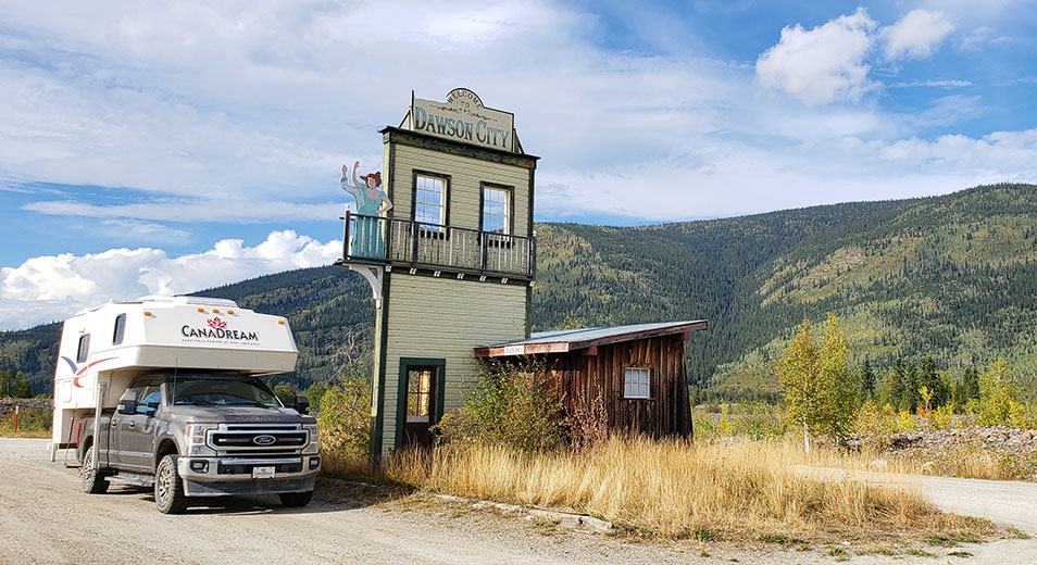
Welcome to Dawson City
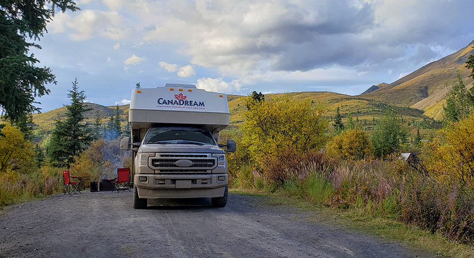
The return trip was just as enjoyable, ending in Dawson City for a couple of nights before heading back down the Klondike Highway to Whitehorse. In Dawson City, we finally got to see the Northern Lights, drove up to Midnight Dome for spectacular views, went gold panning at Claim 6 (a public claim), and took in a show at Diamond Tooth Gerties.
It is truly a bucket-list trip and one we would do again, given the opportunity. If it's also on your bucket list, start planning now. Give CanaDream a call to enquire about renting a truck and camper for the trip. We'd also recommend taking purchasing the rental company's Liability Reduction Zero (LRZ) option or looking into third party insurance. If renting a sat phone for the trip is important to you - check out Up North Adventures.
Planning is essential when preparing to travel the Dempster Highway. Safety Tips, Packing Suggestions and Common Questions about the Dempster Highway can be found in our Planning your Dempster Highway Road Trip page.
You can online chat with CanaDream on their website, email them at booking@canadream.com or phone them for more information about RV Rentals in Whitehorse. Of course, you can also pick up from a different location (a northern surcharge fee applies) and one-ways are often available into and out of Whitehorse (one-way charge applies).
Where we camped:
Dawson City - Dawson City RV Park - Full hookups
Eagle Plains - Electrical Hookups away from the hotel accommodation. Fresh water available at shower block.
Inuvik - Happy Valley Territorial Park. Electrical Hookup. Fresh water and sani dump on site. Laundry and showers on site.
Tuktoyuktuk - The Point. No services. Stop at the Hamlet of Tuktoyaktuk’s office or after hours at the Visitor Centre to pay camping fee. Each site has a picnic table.
Peel River - Nataiinlaii Territorial Park Campground. No hookups, no water fill and no sani dump. Showers and flush toilets.
Dempster Highway - Engineer Creek Campground. No hookups, no water fill and no sani dump. Pit toilets.
Tombstone Territorial Park - Tombstone Campground. No hookups, no water fill and no sani dump. Fresh water is available in buckets but not enough pressure to fill fresh water tank.
Dawson City - Bonanza Gold Motel & RV Park. All services. Flush toilets and showers, Laundromat. RV Wash.
October 16th 2023