Ports & Forts
Overview
Print Page
Route - 1900 km / 1181 mi
| Day | Location | Distance | Duration |
|---|---|---|---|
| 01 | Brampton to Guelph | 65 km / 40 mi | Approx 1 hour |
| 02 | Guelph to Stratford | 90 km / 56 mi | 1.5 hours |
| 03 | Stratford to Pinery Provincial Park | 100 km / 62 mi | 1.25 hours |
| 04 | Pinery Provincial Park to Windsor | 220 km / 137 mi | 3.5 hours |
| 05 | Windsor | 50 km / 31 mi | All Day |
| 06 | Windsor to Amherstburg | 30 km / 19 mi | 30 minutes |
| 07 | Amherstburg to St Thomas | 222 km / 138 mi | 3.75 hours |
| 08 | St Thomas to Nanticoke | 100 km / 62 mi | 1.5 hours |
| 09 | Nanticoke to Niagara Falls | 120 km / 75 mi | 2 hours |
| 10 | Niagara Falls | 150 km / 93 mi | All Day |
| 11 | Niagara Falls to Niagara on the Lake | 30 km / 19 mi | Approx. 30 minutes |
| 12 | Niagara on the Lake to Hamilton | 100 km / 62 mi | 1.5 hours |
| 13 | Hamilton | 100 km / 62 mi | Approx. 2 hours |
| 14 | Hamilton to Brampton | 160 km / 99 mi | Approx 2 hours |
Brampton to Guelph
Guelph to Stratford
Stratford to Pinery Provincial Park
Pinery Provincial Park to Windsor
Windsor
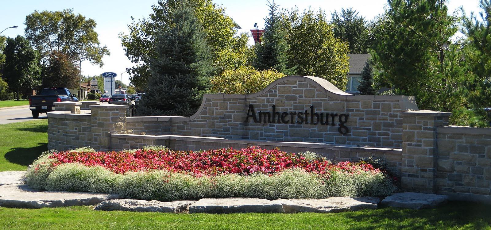
Windsor to Amherstburg
Amherstburg to St Thomas
St Thomas to Nanticoke
Nanticoke to Niagara Falls
Niagara Falls
Niagara Falls to Niagara on the Lake
Niagara on the Lake to Hamilton
Hamilton
Hamilton to Brampton
Trip Details
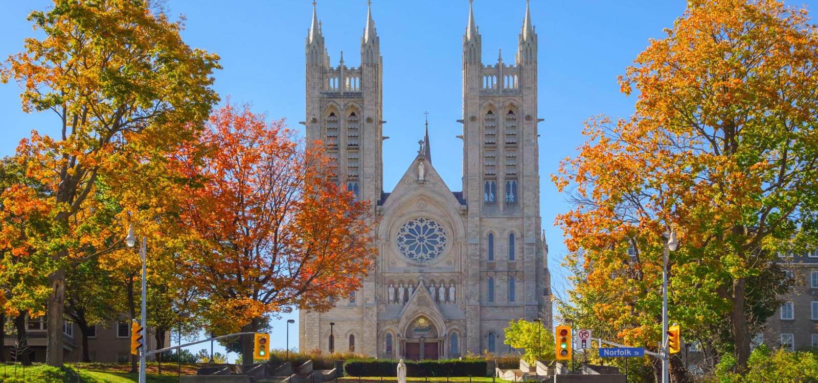
A dominant landmark here is the Church of our Lady of Immaculate Conception, the architecture of which was inspired by the design of the Cologne Cathedral. Renaissance Rival style is evident in the two-story limestone former Guelph City Hall, a national historic site. It now serves as the Provincial Offences Courthouse.
Where to Camp: Green Acre Park, Bingeman’s Camping Resort, West Montrose Family Camp
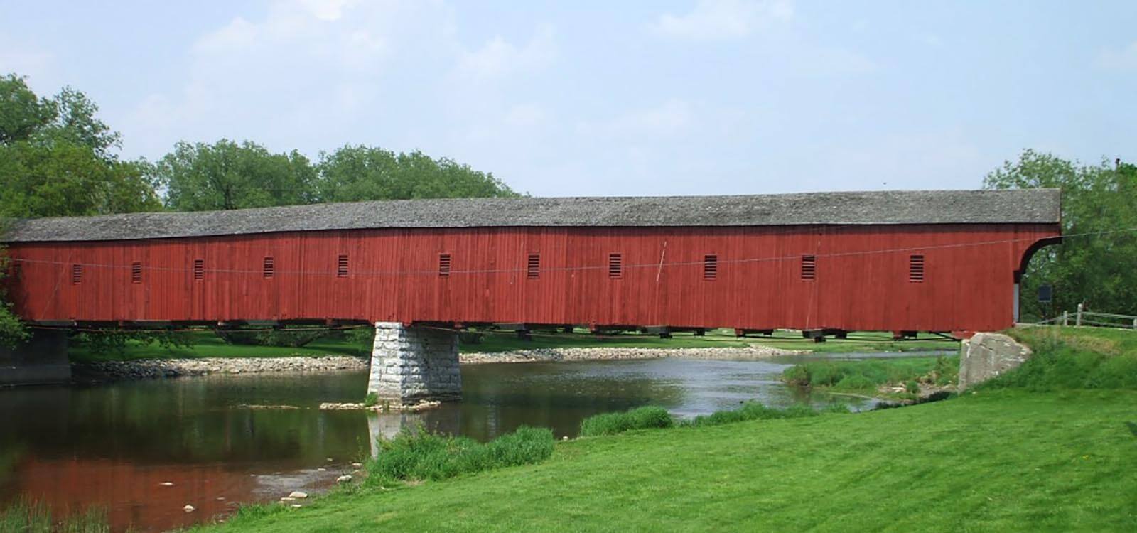
Park your RV on one side and walk across – photo opportunities abound. We’re in Mennonite Country here and it’s not unusual to be sharing the road with a horse and buggy. Make your way into the village of St Jacobs where the Farmer’s Market is the ‘go to’ place for fresh produce. Visit the Mennonite Museum, tracing the old order Mennonite population from migration to the early settlements. The village is also home to unique shops featuring local crafts and a heritage railway running both diesel and steam locomotives. Canada’s Home Hardware chain was born here in 1964.
The Kitchener-Windsor corridor includes the cities of Kitchener, Cambridge and Waterloo. Visit Doon Village, an open-air 60-acre living history museum with a railway station, weaver, harness shop and saw mill powered by a steam engine. John Schneider House in Kitchener is another living history museum, this one recreating life in the 19th century. German immigrants came to the Kitchener-Windsor corridor in the 19th century and their language, religion and cultural traditions live on. Kitchener is home to the world’s second largest Oktoberfest outside of Munich.
Today’s destination is Stratford, best known for staging plays during the Stratford Festival. A prominent building in the town is the red-brick Stratford City hall, built in 1889.
Where to Camp: Windmill Family Resort
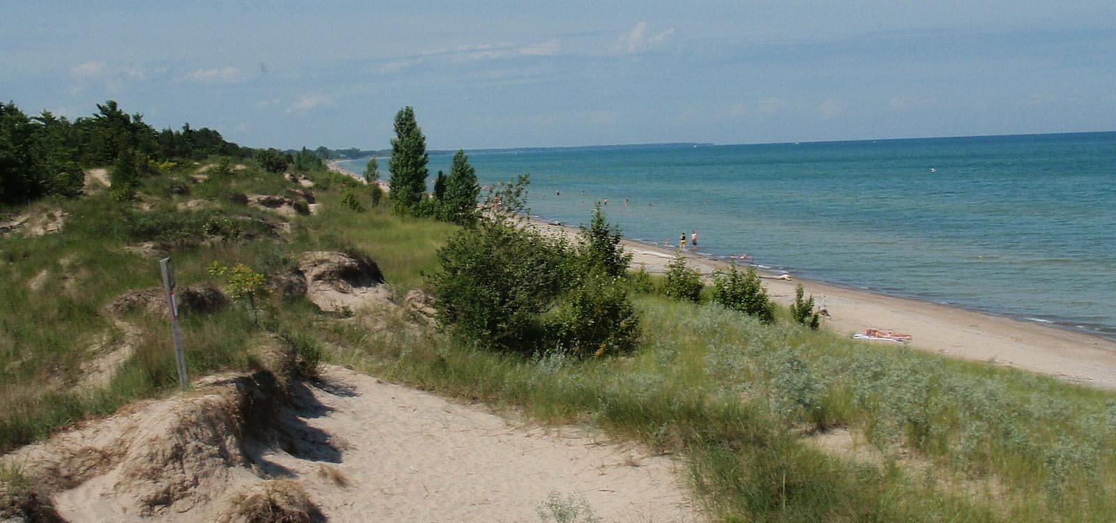
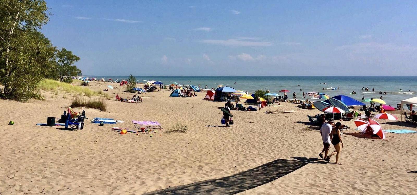
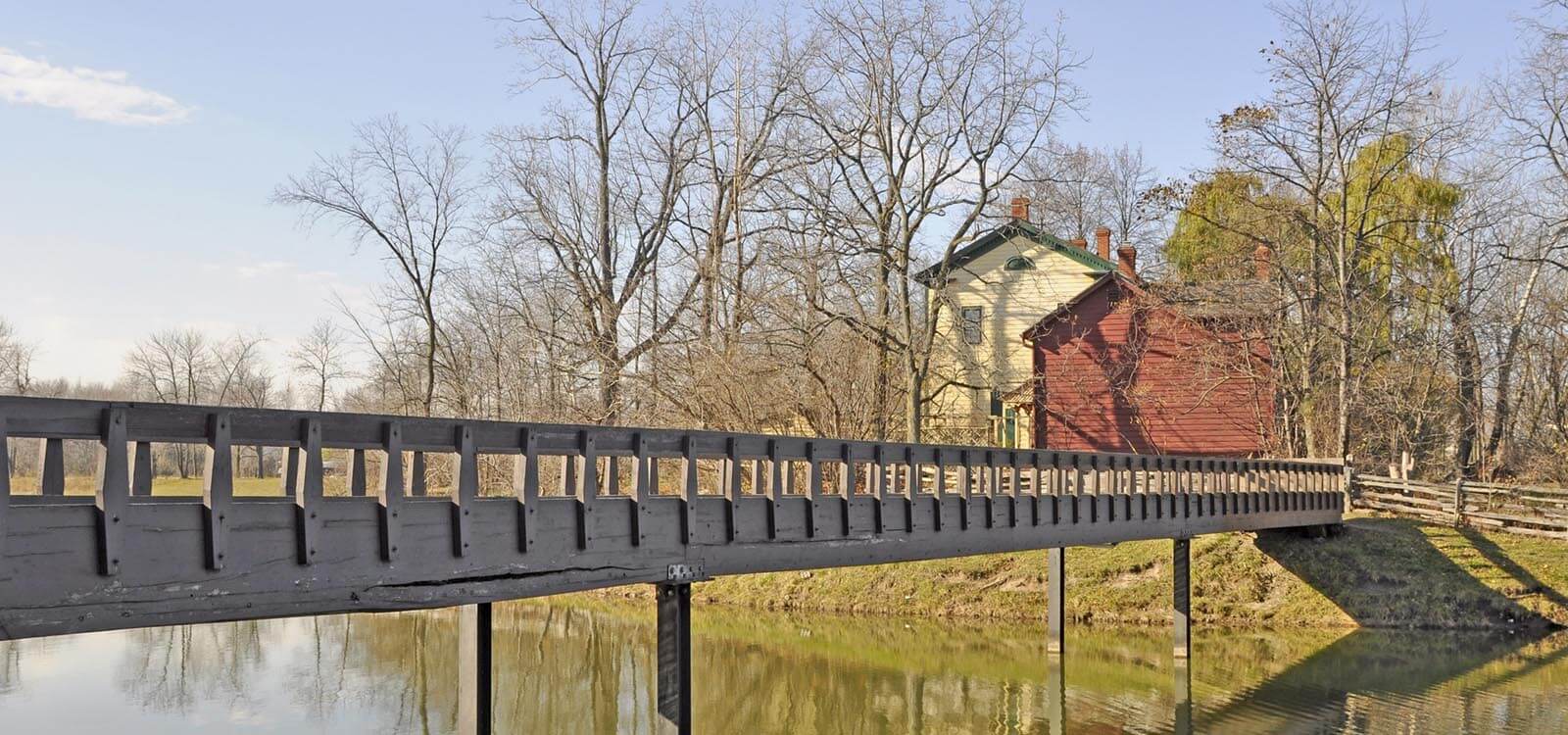
Created to help preserve the oak savannah and the beach dune ecology, this is a very popular park offering RV camping (reservations essential) and 10km of sandy beach shore. The sunsets here are ranks as among the Top 10 Best in the World. En route to the Pinery, stop in Saint Mary’s, known as “Stonetown” for the limestone blocks quarried near the banks of the Thames River. Saint Mary’s Presbyterian Church is a landmark noticeable by its 40 steeples. Junction Station* is an outstanding example of early railroad architecture set on the Grand Trunk line to Sarnia. Markers show the way to the railway historic bridge, water tower, museum and train station gallery.
Where to Camp: Pinery Provincial Park – be sure to make reservations in advance.
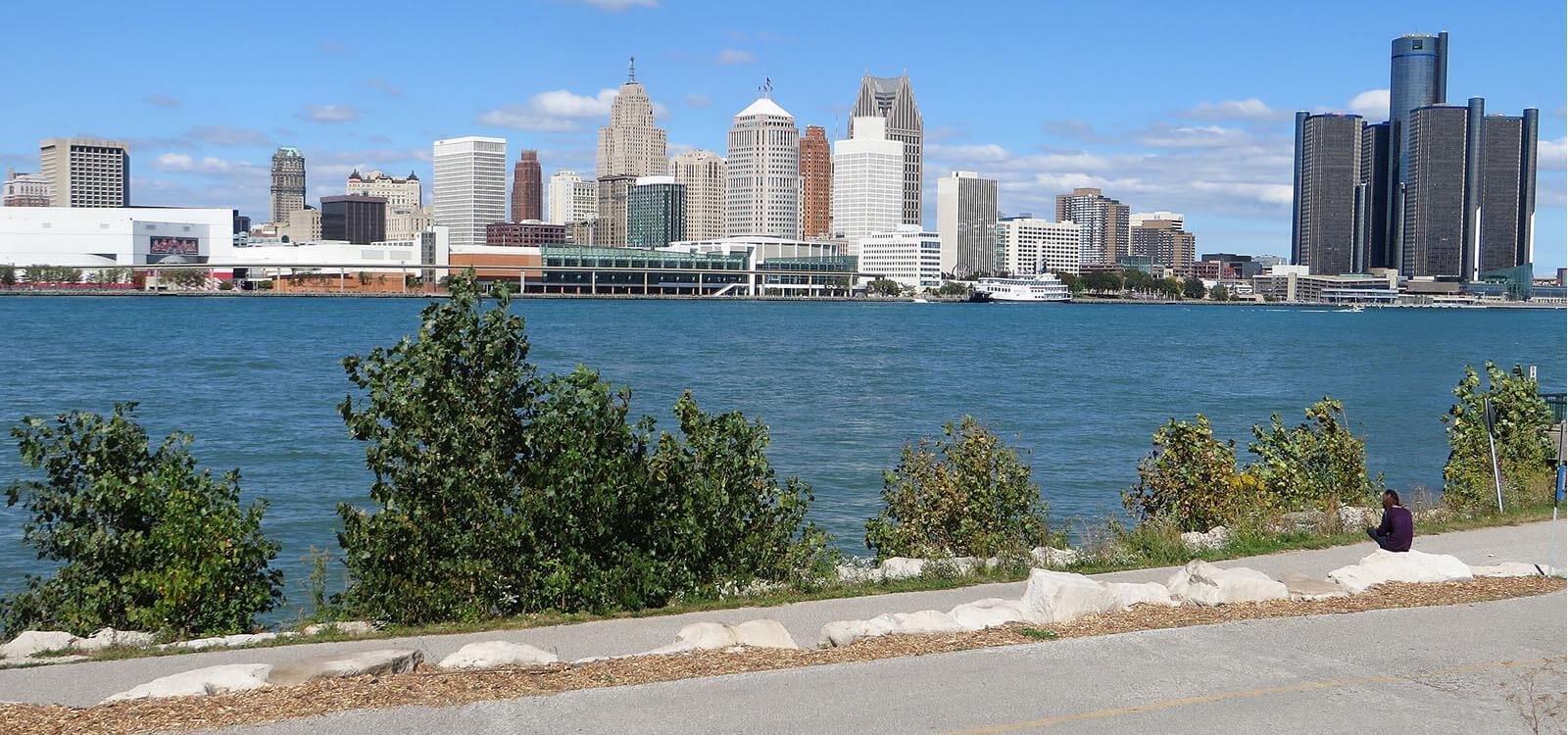
Choose to take a direct route south or take the St Clair Parkway for a more scenic route, joining Highway 40 south. Hang out this afternoon at Waterfront Park, stretching about 5 km west from the 1929 Ambassador Bridge with access on Riverside Drive. Enjoy walking paths and an unrivalled view of the Detroit Skyline.
Where to Camp: Windsor Campground
The River Rouge Auto plant still operates today (tours are available). Visit Greenfield Village, established by Henry Ford in 1933, who relocated buildings there from throughout the United States. If you prefer to stay on the Canadian side of the river, the Sandwich district is worth a visit. Old Sandwich Town has descriptive murals and plaques in a small park at the Harbour Masters building, telling the tales of the settlement of the area. The First Baptist Church dates from 1851 and is representative of churches from this period. A display at the Windsor Port Authority yard pays tribute to the Battle of Lake Erie resulting in the British abandoning Detroit. A self-guided walking tour takes you past historic sites and buildings.
Where to Camp: Windsor Campground
The museum explores the history of African-American refugees in western Ontario who sought freedom from slavery and made their homes here.
Visit Park House, considered to be one of the oldest houses in the region. The Holiday Beach Conservation Area is one of the best fall birding sites in North America for viewing migratory birds, particularly birds of prey.
Where to Camp: Sun Retreats Amherstburg
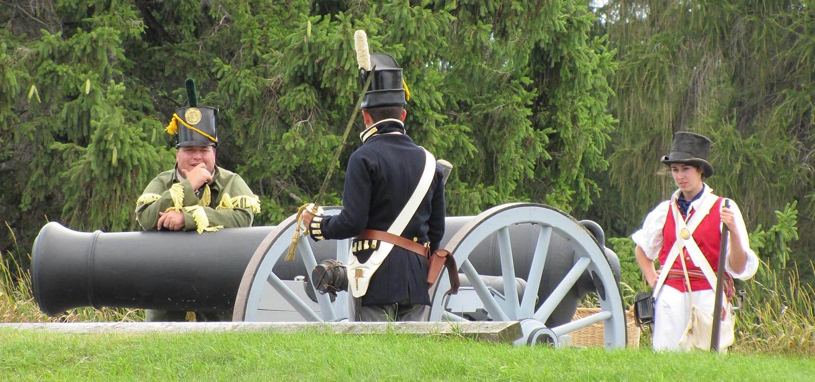
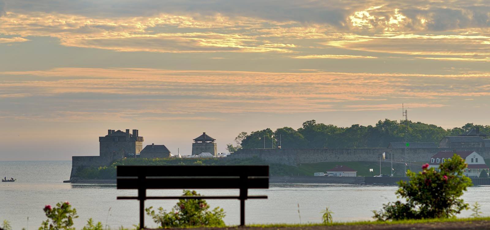
It is a national historic site featuring interpretative displays, costumed guides and musket firing . Close by, the Amherstburg Navy Yard National Historic Site, known as Navy Yard Park, was a former British Navy yard evacuated by the Royal Navy in 1813. For almost 20 years, the yard produced vessels ranging from small, open bateaux, to full-sized, three-masted, ship-rigged men-of-war. Today the site features no visible remains but is marked by a four-sided monument featuring four brass Historic Sites and Monument plaques.
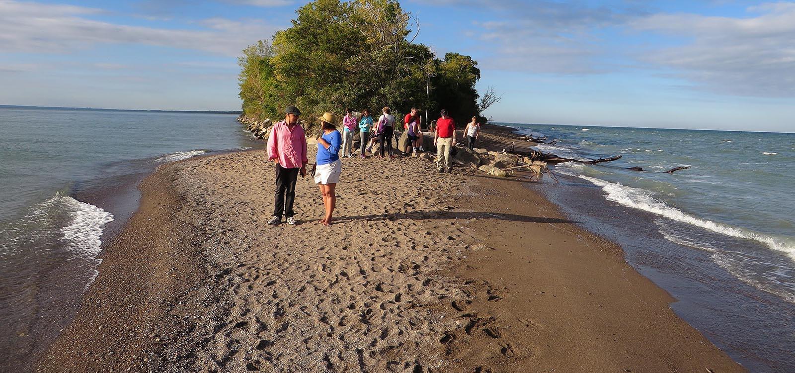
From Fort Malden, take Hwy 3 to Leamington, the tomato capital of Canada. The surrounding area here is known for large greenhouse operations. A 90-minute ferry service to Pelee island leaves from the historic dock where the remains of a lighthouse stand at the tip of the spit. Biking and hiking are popular here. Leamington is the entrance point to Point Pelee National Park. Known as the “100 Mile Peninsula”, Point Pelee is the most southerly point in Canada. Continue on to Wheatley, home to the most productive commercial fishery of all the Great Lakes. Follow the Talbot Trail lakeside. Rondeau Provincial Park has 11km of sandy beaches and is renowned as a bird-watching destination in the Springtime, attracting birdwatchers from across North America.
Port Stanley is famed for a short-line tourist train re- established on the roadbed of the London & Port Stanley Railway. PSTR operates five diesel-electric locomotives from the 1940s along with nine colourful passenger cars during a one-hour train ride. It was one of the first railroads built in Ontario, starting in 1856
End today in St Thomas, home to the North America Railway Hall of Fame. Box car murals are featured at Elgin County Railway Museum.
Where to Camp: Dalewood Conservation Area, Port Burwell Provincial Park, Long Point Provincial Park
Hug the coastal roads as you head east through many communities bearing the word “Port” before their names. Port Burwell is known as the "jewel of Erie's North Shore".
Located at the mouth of Big Otter Creek, Port Burwell is home to an historic lighthouse, a marine museum, marinas and beaches. The lighthouse was constructed in the 1840s and is home to the tourist information centre.
Between Port Royal and Port Rowan, there’s a turnoff on Hwy 59 to Long Point Provincial Park and Big Creek National Wildlife Area. The wetlands at Big Creek provide an essential habitat for an assortment of rare plants animals, insects, fish, reptiles and amphibians. The woody swamp environment of the Hahn Woods provides a nesting habitat for at least 30 species of birds.
The pier at Port Dover is a favourite place for tourists to stroll. Seats line the walk leading out to a small lighthouse making for an enjoyable place to relax on a hot day.
While primarily an agricultural area, Nanticoke is also a highly industrialized community. Home to the Stelco Lake Erie steel works, the Nanticoke Refinery and the Nanticoke Generating Station, this city was designated a Canadian national historic site in 1924.
Where to Camp: Rock Point Provincial Park, Selkirk Provincial Park
At Selkirk, the Blue Water Pathway joins with Lakeshore Road to enable you to continue your lakeside journey to James N Allan Provincial Park. The undeveloped shore here includes one kilometre of pebble beach and 100 metres of beach with fine sand. It’s a non-operating park with no facilities. The quickest way across Grand River is via Hwy 49 and Rainham Road where you can join Hwy 3 (North Shore Drive) to continue your coastal journey into Port Colborne at the southern terminus of the Welland Canal. Highway 3 continues on to Fort Erie (open Memorial Day to Labor Day), once a garrison during the War of 1812. There are numerous hiking trails in the area including miles of sandy beaches along the Lake Erie shoreline. From Fort Erie, it’s a short drive into Niagara Falls on Queen Elizabeth Way.
Where to Camp: Campark Resorts, Jellystone Niagara Camp Resort, Niagara Falls KOA
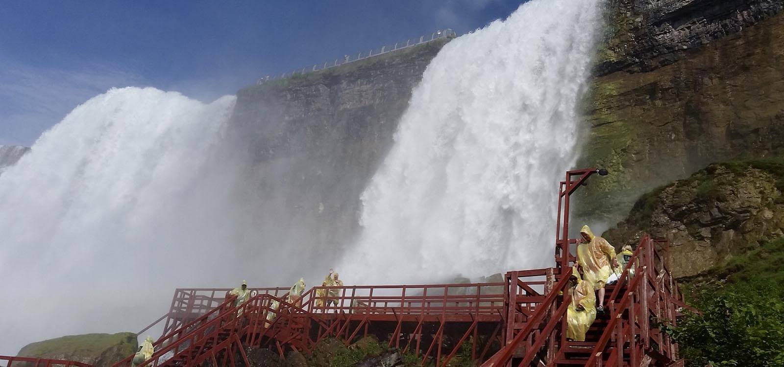
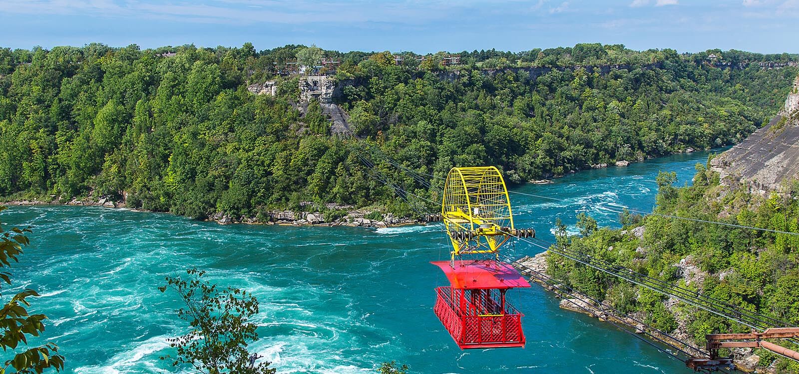
Stroll between the best viewpoints of the famous horseshoe Falls from alongside the river ledge in front of Queen Victoria Place. Highlights include Niagara City Cruise river tour below the falls and the 160 m high Skylon Tower with an observation deck overlooking the curving crest of the 180 m Horseshoe Falls and American Falls from the Canadian side of the Niagara River. The Aerial Cable Car spans 540 m over the Whirlpool Rapids where the Niagara River rushes through the gorge at 2,800 cubic meters/sec. The Sir Adam Beck Generating Complex* landmark offers interactive displays to illustrate hydropower development at the first major power plant on the Canadian side of the Niagara River. Find deals with an Attractions Pass.
Where to Camp: Campark Resorts, Jellystone Niagara Camp Resort, Niagara Falls KOA
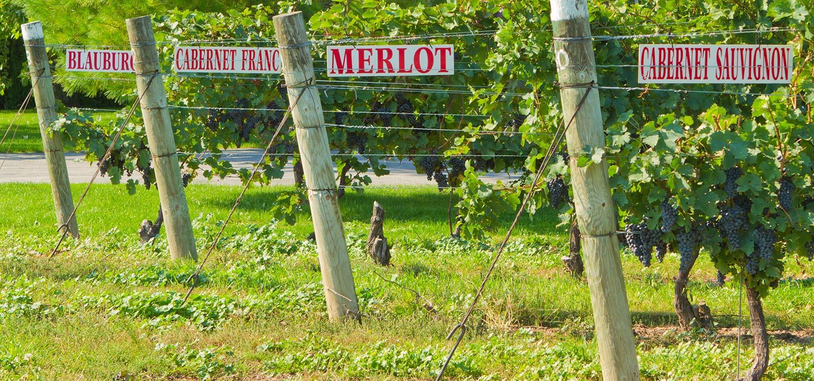
You're in wine country here. As you travel country roads, you'll see vineyards in all directions - more than 50 of them spread over an area of more than 5000 hectares. The Niagara peninsula is the largest and most concentrated winemaking region in Canada. Call in to a winery or two to enjoy mouth-watering wines year-round including varietals such as Canrdonnay, Riesling and Pino Noir.
The historic district of the town of Niagara-on-the-Lake was the first capital of Upper Canada in the 1790s and is today a National Historic Site. The district covers 25 city blocks with the majority of the buildings being constructed between 1815 and 1859 in the British Classical Tradition.
Where to Camp: Campark Resorts, Jellystone Niagara Camp Resort, Niagara Falls KOA
Fort Mississauga was built between 1814 and 1816 to replace Fort George and counter Fort Niagara on the American side of the Niagara River. It was also the site of the first lighthouse in Upper Canada. The site is mainly ruined, but you can follow a lakeshore trail which extends from Fort George to Fort Mississauga.
Head southwest on Highway 87 to Port Weller, crossing the canal at Lakeshore Road. Port Weller is the point of entry to the Welland Ship Canal enabling ships to move from Lake Ontario to Lake Erie. The Welland Canals Parkway follows the canal south into the city of St Catharines. Four locks are within the town’s borders. The Garden City Skyway crosses the canal to allow vessels up to 35.5 metres’ clearance to pass beneath. Visit the Welland Canal Centre which includes a history exhibit and an observation area above Lock 3. Continue on to Hamilton for your overnight stay.
Where to Camp: Olympia Village RV Park, Pine Valley Park, Maple Grove RV Resort
Visit the Royal Botanical Gardens, Canada’s Warplane Heritage Museum, and Stoney Creek Battlefield Monument at the site of a decisive battle during the War of 1812. Explore the stately 40-room Dundurn Castle. Take the Lincoln Alexander Parkway to the Devil’s Punch Bowl along the Ridge Road on Hwy #7. The Devil’s Punchbowl was formed at the end of the last ice age by huge melt-water rivers that plunged over the Stoney Creek Escarpment, carving out the seemingly endless Punchbowl and gorge.
Head out to Fifty Point Conservation Area on the shores of Lake Ontario featuring family camping, boating, hiking, birding and fishing. Enjoy fabulous lakefront views as you walk the promenade or just chill out on the beach.
Where to Camp: Olympia Village RV Park, Pine Valley Park, Maple Grove RV Resort, Fifty Point Consrevation Area
Allow enough time to arrive at the drop-off location for your designated drop-off time window.


