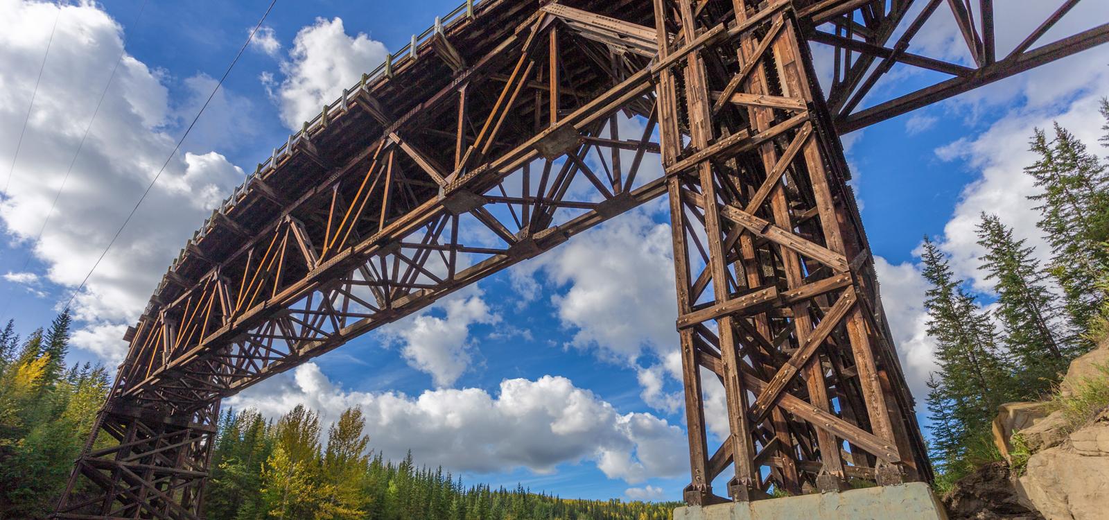
The Deh Cho Connection
Overview
Print Page
Route - 3502 km / 2176 mi
| Day | Location | Distance | Duration |
|---|---|---|---|
| 01 | Edmonton to Grande Prairie | 459 km / 285 mi | Approx. 4 hours 40 minutes |
| 02 | -- | ||
| 03 | Grande Prairie to Manning | 256 km / 159 mi | Approx. 2 hours 41 minutes |
| 04 | Manning to High Level | 193 km / 120 mi | Approx. 1 hour 56 minutes |
| 05 | High Level to Enterprise area or Hay River, NWT | 312 km / 194 mi | Approx. 5 hours |
| 06 | Travel to Fort Simpson | 875 km / 544 mi | Approx. 11 hours 41 minutes |
| 07 | -- | ||
| 08 | -- | ||
| 09 | Fort Simpson to Fort Liard and Fort Nelson | 429 km / 267 mi | Approx. 10 hours 20 minutes |
| 10 | -- | ||
| 11 | Fort Nelson to Fort St John | 380 km / 236 mi | Approx. 3 hours 56 minutes |
| 12 | Fort St John to Grande Prairie | 205 km / 127 mi | Approx. 2 hours 23 minutes |
| 13 | Grande Prairie to Edmonton | 396 km / 246 mi | Approx. 4 hours 37 minutes |
| 14 | -- |
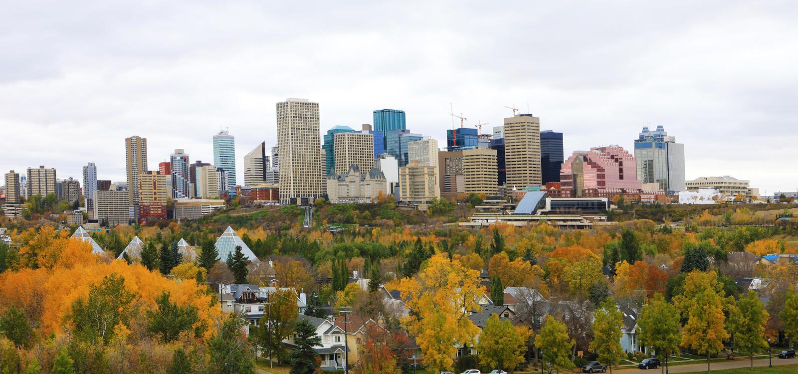
Edmonton to Grande Prairie
Your Deh Cho Connection journey begins in Edmonton as you head north to the town of Grande Prairie. Make the journey in one day or split your drive over two days.
Grande Prairie to Manning
Manning to High Level
High Level to Enterprise area or Hay River, NWT
Travelling along Highway 35, the road eventually becomes NWT Highway 1, also known as the Waterfalls Route. You’ll end your day in Enterprise or take a side trek to Hay River.
Travel to Fort Simpson
Fort Simpson to Fort Liard and Fort Nelson
From the junction of Highways 1 and 7, the road takes you to Fort Liard, just north of the NWT/BC border. Crafts, culture and outdoor recreation are the mainstays of tourism in Fort Liard but there are a number of interesting places to check out.
Fort Nelson to Fort St John
Fort St John to Grande Prairie
Grande Prairie to Edmonton
Leave Grande Prairie today and take Highway 43 back to Edmonton. Or, if you’d like to extend your trip and visit the Rocky Mountains, take Highway 40 south through Grande Cache and William A Switzer Provincial Park to Jasper.
Trip Details
Your Deh Cho Connection journey begins in Edmonton as you head north to the town of Grande Prairie. Make the journey in one day or split your drive over two days.
Depending on your pick-up time and familiarity with your vehicle, you may like to travel only a short distance today, perhaps stopping at Alberta Beach, located on the shores of Lac Ste. Anne.
If you prefer to continue further, we suggest you consider staying in Whitecourt, 177km northwest of Edmonton. This community was formed in the place known by the Cree as Sagitawah (the place where the rivers meet) and its economy is driven primarily by forestry, oil and gas, and tourism.
Another option is Fox Creek – 266km from Edmonton where there is a nice campground with space available on a first come first served basis. Fox Creek is located within 12 km (7 mi) of three lakes – Smoke Lake to the southwest, Losegun Lake to the north and Raspberry Lake to the northeast.
On Day 2, continue your journey on to Grande Prairie, one of the starting points on the Deh Cho Travel Connection.
CanaDream Club Partners
Today you’ll head out of Grande Prairie on Highway 2 towards Grimshaw, Mile 0 of the original Deh Cho Travel Route.
24km East of Grimshaw and slightly off-route, you’ll find the charming town of Peace River. If you’d like to spend more time in and around Peace River, we suggest you take the scenic drive along the Shaftesbury Trail on Highway 684 which follows the west side of the river. It's worth spending maybe a night or two here before continuing as there's lots to see and do in the Mighty Peace region.
Continuing on the Mackenzie Highway, you’ll pass through the small town of Dixonville before reaching your overnight destination at Manning, known as the “Land of the Mighty Moose” for its exceptional moose and elk.
The closest campground is the Manning Lions Campground backing onto the Notikewin River and just across the street from the Visitors Centre. Make sure to check out options on our CanaDream Club app to take advantage of local discounts.
CanaDream Club Partners
Today you’re on your way to High Level. If you enjoy fishing, stop and fish at Notikewin Provincial Park or in the small stocked lake at Twin Lakes Recreational Area. At the junction of the Mackenzie Highway and Highway 697 you may like to take a slight circle route diversion through the Mennonite community of La Crete to Fort Vermilion. Take the Tompkins Landing Ferry, which glides across the river transporting several vehicles at once at no charge, then continue on to La Crete and into Fort Vermilion and High Level.
The town of High Level is the midway point between Edmonton and Yellowknife. The name High Level describes the height of the land that separates the Peace River and the Hay River. There is plenty of good fishing in the area for Northern Pike, Walleye, Perch, Whitefish, Grayling and Goldeye. Hunters can find moose, deer, bear and geese. There are over 150 species of birds that nest in the area.
Travelling along Highway 35, the road eventually becomes NWT Highway 1, also known as the Waterfalls Route. You’ll end your day in the Enterprise area (town was devastated by wildfire in 2023) or take a side trek to Hay River.
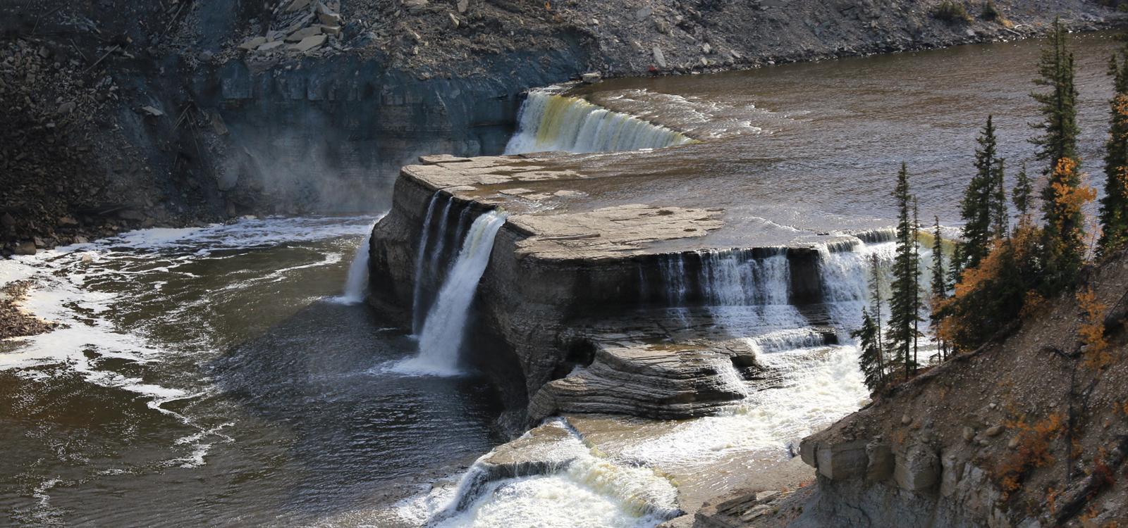
Highway 35 continues on from High Level to the towns of Meander River and then Indian Cabins. North of Indian Cabins, you cross from Alberta into the Northwest Territories, at the 60th Parallel. Don’t miss the Visitor Centre, where first-time tourists are awarded a North of 60 Certificate. Highway 35 now becomes NWT Highway 1, also known as the Waterfalls Route. To see why, stop at Twin Falls Gorge Territorial Park and take the trail that connects Alexandra and Louise Falls. The Dene Aboriginal people of this region call Alexandra Falls “Hatto deh Naili,” a place of power protected by spirits. Louise Falls cuts through stone formations that date back 400 million years.
Consider side trips to Great Slave Lake from Hay River or Fort Smith or to Wood Buffalo National Park – see route below.
Side Trip - Enterprise Area to Fort Smith, Return (587 km/367 mi), +2-3 days
If you’re interested in checking out the points of interest on this side trip we recommend you leave the Mackenzie Highway (NWT Hwy #1) and travel Hwy #2 to Hay River “Port of the North”, a town of 3,500 and a major transportation hub for the north. Hay River offers great fishing and hosts one of several beautiful golf courses in the NWT.
Travel Hwy #5 east/southeast from Hay River to reach Fort Smith - home to the Northern Life Museum, world- renowned Slave River Rapids and gateway to Wood Buffalo National Park.
At 45,000 sq km, Wood Buffalo is the second largest national park in the world. It’s a naturalist paradise with free roaming bison, nesting grounds of the endangered whooping crane, amazing geographical wonders including the spectacular Salt Plains karsts landscape and much more.
The Deh Cho Travel Connection continues west on Mackenzie Highway 1, parallel to the Mackenzie River as it crosses the boreal plains. If your plans include a visit to Yellowknife, the capital of the Northwest Territories, allow an additional 2-3 days in your trip.
Side Trip: Yellowknife, Return (680 km/425 mi), +2-3 days
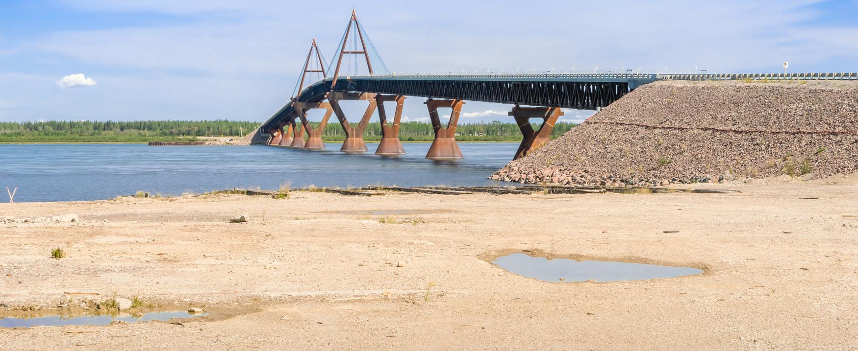
Cross the wide, fast flowing Mackenzie River on their newly built bridge. On the way, stop at historic Fort Providence - the craft shop specializes in moose hair tufting. Gas up here, as there are no services along Highway 3 for another 224 km (139 mi). As you drive north you enter the vast Mackenzie Bison Sanctuary.
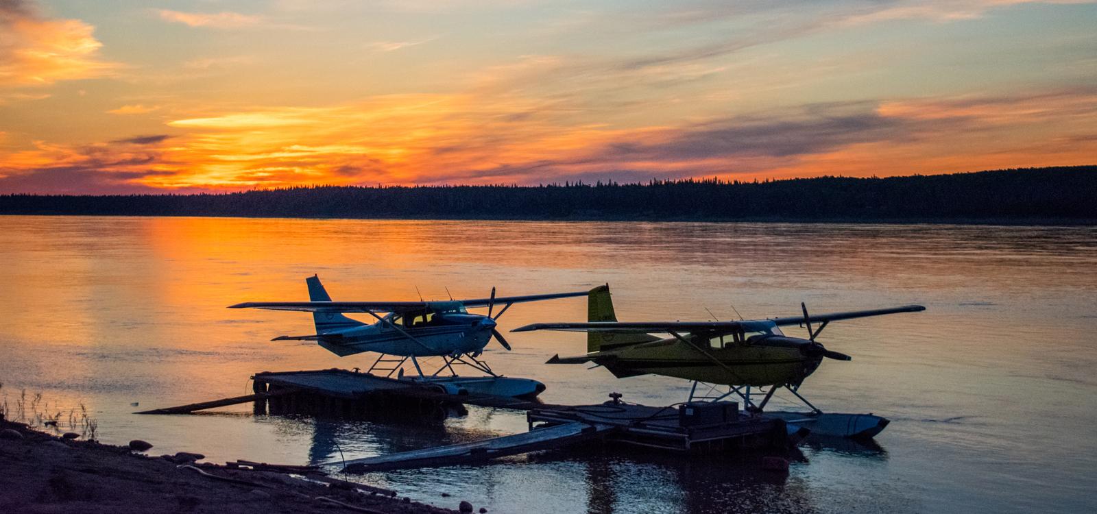
Yellowknife, population 18,000, is located 340 km (211 mi) north of the junction of Highways 1 and 3. It has all the services of a large city with small city friendliness. Founded on gold mining, diamonds now provide the glitter. There is plenty to see and do including canoeing, hiking, fishing, golfing and swimming. Join in summer festivals, visit the Prince of Wales Northern Heritage Centre, the Northwest Territories Legislative Assembly or drive the Ingraham Trail.
Back on the Deh Cho route, the Mackenzie Highway continues west to Sambaa Deh Falls Territorial Park, located on a bluff overlooking the Trout River near Coral Falls – an excellent fossil hunting location.
Still on Hwy 1, the Waterfalls Route becomes the Heritage Route, as it continues north to Fort Simpson, from the junction of Highways 1 and 7. The largest community in this region and the oldest former trading post on the Mackenzie River, this town at the confluence of the Liard and Mackenzie Rivers boasts a population of 1,200. Stop at the Fort Simpson Park and Visitors’ Centre to learn about trips into Nahanni National Park.
CanaDream Club Partners
From the junction of Highways 1 and 7, the road takes you to Fort Liard, just north of the NWT/BC border. Crafts, culture and outdoor recreation are the mainstays of tourism in Fort Liard but there are a number of interesting places to check out.
The Liard Highway continues past Ford Liard for another 200km and ends in Fort Nelson where we suggest you make an overnight stop.
Situated at Mile 300 on the Alaska Highway, Fort Nelson is a major stopover destination for those traveling to the Yukon and beyond. Pioneer artifacts, full-length animal displays and a display on the Alaska Highway construction can be viewed at the Fort Nelson Heritage Museum located across the Alaska Highway from the Recreation Centre.
Side Trip: Fort Nelson to Liard Hot Springs, Return (610km / 381mi), +2-3 days
From Fort Nelson, a side trip north along the Alaska Highway leads into the Northern Rocky Mountains offering spectacular scenery and wildlife viewing and on to Stone Mountain and Muncho Lake Provincial Park. At the Liard River Hot Springs you can enjoy the second largest natural hot pools in Canada year-round.
You may like to extend your side trip further and drive the entire length of the Alaska Highway, continuing on from Liard River to Watson Lake and Whitehorse. From Whitehorse you can connect with our Northern Lights Adventure or Golden Circle tours, which take you to the best of Alaska and the Yukon.
Today you’ll join the Alaska Highway to Fort St John. South of Fort Nelson at Mile 281, you will reach the Muskwa Bridge, the lowest point on the Alaska Highway at 1,000 feet. The Summit, at Mile 374, is the highest point on the highway at 4,250 feet.
The surrounding scenery is the major highlight on today’s drive. Mile 143 on the Alaska Highway brings you to the small roadside hamlet of Pink Mountain in the Rocky Mountain Foothills, northwest of Fort St John. Pink Mountain glows a vibrant pink colour at a certain time during sunrise.
During the wildflower bloom, Pink Mountain looks, well, pink from a distance because of all the fireweed blossoms. If you miss this awesome phenomenon, you can still take pictures of the surrounding panoramic landscape from the peak of Pink, or continue on for 10 kilometres for views of Lilly Lake, Moose Lick Creek, and Halfway River. Pink Mountain's real claim to fame is the high population of rare Arctic butterflies found here, attracted by the region's blossoms.
Continue on through Wonowon to your overnight destination at Fort St John where local hospitality is complemented by the natural beauty of the city and the surrounding Peace River.
There’s plenty of opportunity today to get out and explore. How about a side trip into BC’s Dinosaur Country? Head slightly north of Fort St John to the junction of Highways 97 and 29 and turn off onto Highway 29. The communities of Tumbler Ridge and Hudson’s Hope are located in the middle of the “new’ Dinosaur Country.
From Tumbler Ridge take Highway 52 to Dawson Creek, located at Mile 0 of the Alaska Highway. Mile Zero welcomes you with a Visitors’ Centre and Museum located in the historic railway station. Other sights include the Mile Zero Signpost and Walter Wright Pioneer Village.
Continue on Highway 43 from Dawson Creek to Grande Prairie to complete the Deh Cho route.
Leave Grande Prairie today and take Highway 43 back to Edmonton to return your vehicle to our Edmonton location. Overnight in Edmonton before returning your vehicle between 8.00am and 10.00am the following morning.
Alternative Option: Grande Prairie to Jasper
If you’d like to extend your trip and visit the Rocky Mountains, take Highway 40 south through Grande Cache and William A Switzer Provincial Park to Jasper. Highway 40 joins Highway 16 (The Yellowhead Highway) just west of Hinton.
For ideas of things to do and see in the Jasper area, please refer to Day 9 of our Southern BC to the Rockies Circle tour. When your stay in Jasper is over, head back east on the Yellowhead Highway to Edmonton.
CanaDream Club Partners


