Sunshine Coast
Overview
Print Page
Route - 424 km / 263 mi
| Day | Location | Distance | Duration |
|---|---|---|---|
| 01 | Vancouver to Gibsons | 72 km / 45 mi | Approx. 1 hour 49 minutes |
| 02 | Gibsons to Earls Cove | 78 km / 48 mi | Approx. 1 hour 13 minutes |
| 03 | Earls Cove to Powell River | 50 km / 31 mi | Approx. 1 hour 30 minutes |
| 04 | Powell River to Lund | 28 km / 17 mi | Approx. 31 minutes |
| 05 | Lund to Sechelt | 130 km / 81 mi | Approx. 2 hours 45 minutes |
| 06 | Sechelt | ||
| 07 | Sechelt to Vancouver | 66 km / 41 mi | Approx. 2 hours 7 minutes |
Vancouver to Gibsons
Gibsons to Earls Cove
Earls Cove to Powell River
Powell River to Lund
Lund to Sechelt
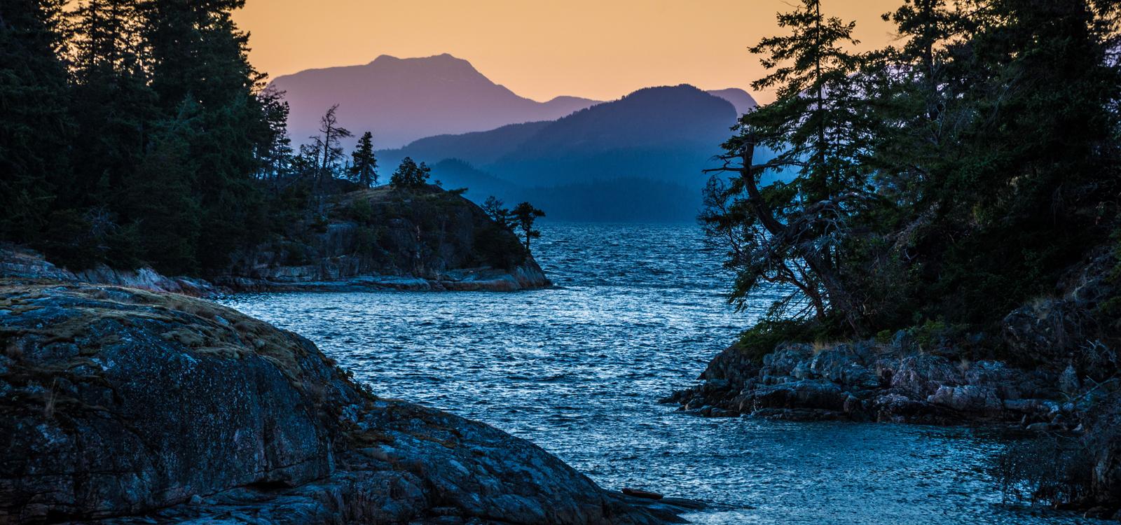
Lund's harbour is home to a fleet of commercial prawn boats, sail boats, recreational motor vessels and water taxi services which deliver people and goods to Savary Island, known for it's white sandy beaches.
Sechelt
Sechelt to Vancouver
Trip Details
The only way to reach Gibsons is via the Horseshoe Bay ferry, as the overland route is too mountainous to build roads. The ferry to Langdale takes approximately 40 minutes at a distance of approximately 9.7 nautical miles. When you arrive, head to your chosen campground for the night. You can settle in for a comfortable night in this town of about 4,000. The most notable claim-to-fame for Gibsons Landing is the hit TV show, "The Beachcombers", as it was filmed there and ran from 1972 until 1990.
Some of the beautiful parks to explore today include Roberts Creek or Sargeant Bay Provincial Parks or spend a relaxing day exploring the village of Sechelt. Wander around the artisanal shops, or enjoy some great local cuisine, browse museums and check out markets or festivals.
If you were to drive straight through to Earls Cove from Gibsons, you would arrive there in just over an hour. However, with the incredibly scenic drive and gorgeous parks to stop at along the way, why pass up the opportunity?
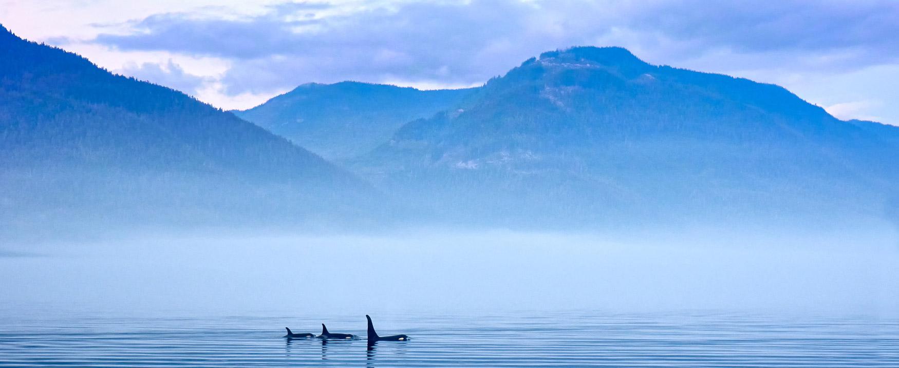
When you're in the Earls Cove/Egmont region of the Coast, the Skookumshuck Rapids at Egmont are an awesome sight to take in when the tide is coming in or going out. Or, head over to Sunshine Coast Tours to take in their Princess Louisa Inlet tour.
CanaDream Club Partners:
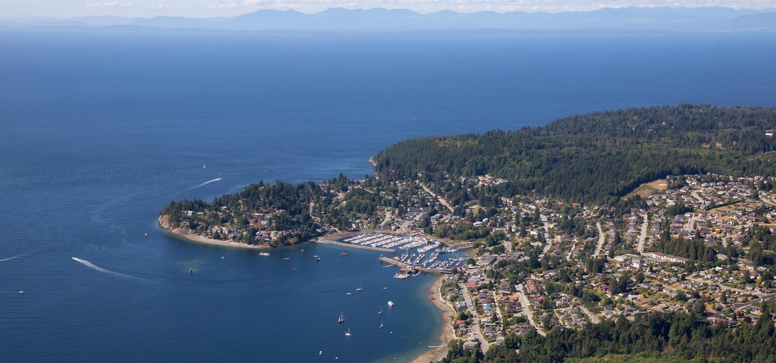
Powell River is home to almost 13,000 residents and activities such as scuba diving, kayaking, fishing, swimming and canoeing can be enjoyed by water lovers. Consider heading to Duck Lake Protected area, a 20-minute drive east of Powell River where there is about 9 km of hiking and mountain biking trails within the area.
The trip from Earls Cove to Powell River is completed in two legs: the first is by hopping on the ferry to Saltery Bay and the second is on the Sunshine Coast Highway to Powell River.
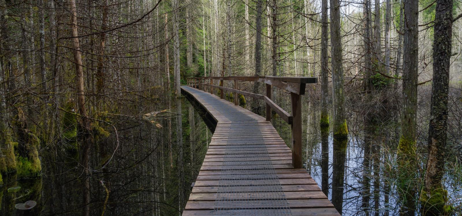
Leaving Duck Lake and traveling north along the Haslam Lake Road for about half an hour, you will reach Inland Lake. Enjoy activities such as wildlife viewing, hiking, fishing, cycling and canoeing. Why not take a kayak or hiking tour in this area? Let professional guides lead you into the tranquil Desolation Sound. When you're ready to settle in for the night, we can recommend Garnet Rock Oceanside Resort.
Heading up the Sunshine Coast Highway for the final north-bound leg of the tour, you will reach Lund in just over half an hour.
However, to explore some of the provincial parks in the region, you will need to take the Malaspina Road, heading east, a couple kilometres south of Lund. Okeover Provincial Park is located on a traditional Sliammon First Nations archeological site.
To reach Malaspina Provincial Park, you will need to take Malaspina Road back to the Sunshine Coast Highway and connect to the Sarah Pointe Road just north of Lund. The trip takes about eight minutes and you will need to walk from Sarah Pointe Road into the park. This park provides a low elevation coastal hiking and backcountry recreation experience. The Desolation Sound area is very popular for kayaking and boating.
Lund's harbour is home to a fleet of commercial prawn boats, sail boats, recreational motor vessels and water taxi services which deliver people and goods to Savary Island, known for it's white sandy beaches.
Returning to Sechelt down the Sunshine Coast will take about three hours. When you return to the Sechelt region, take Brooks Road eastward (approximately 16 km northwest of Sechelt off Highway 101/Sunshine Coast Highway) to Smuggler Cove Marine Provincial Park. The park is a gorgeous, all-weather anchorage on the south side of the Sechelt Peninsula where you can see the work from its resident beavers.
As you leave Smuggler Cove and make your way into Sechelt, head north on Wharf Avenue to East Porpoise Bay Road (which becomes Sechelt Inlet Road) to Porpoise Bay Provincial Park. The park is noted as a second-growth forest of alder, western hemlock, western cedar, Douglas fir and maple trees. There is also a spawning channel area for chum and coho salmon and an estuary that hosts numerous types of shore birds. It's a relaxing, beautiful way to spend your afternoon in the Sechelt area.
Sechelt is one of two larger towns on the Sunshine Coast and is home to 9,500 residents. Enjoy your day of relaxing and discovery in this beautiful part of British Columbia.
Downtown has coffee shops, art galleries, bakeries, a First Nations' gift store (with art by local First Nations' artists), a beer and wine store, gelatoria and a movie theatre.
In West Sechelt you will find the Sunshine Coast Botanical Garden - about a 10-minute drive from downtown Sechelt. We can recommend the Bayside Campground as your home base in the Sechelt area. Make sure you check out the CanaDream app for more details.
CanaDream Club Partners:CanaDream Club Partners:
- Eagle Wind RV Park
- Pacific Border RV Park
- Peace Arch RV Park
- Burnaby Cariboo R.V. Park
- Vancouver Whale Watch
- Quality Hotel Airport
- Sandman Signature Hotel
- Landsea Tours & Adventures
- Sandman Vancouver City Centre
- Vancouver Lookout
- Harbour Air Seaplanes
- Harbour Cruises Ltd.
- Stanley Park Horse-Drawn Tours
- Vancouver Aquarium
- Talaysay Tours
- Capilano River RV Park
- Capilano Suspension Bridge
- Grouse Mountain
- Vancouver Foodie Tours


