The Grand Adventure
Overview
Print Page
Route - 1762 km / 1095 mi
| Day | Location | Distance | Duration |
|---|---|---|---|
| 01 | Calgary to Mayerthorpe | 420 km / 261 mi | Approx. 4 hours |
| 02 | -- | ||
| 03 | Mayerthorpe to Jasper | 340 km / 211 mi | Approx. 3 hours 10 minutes |
| 04 | -- | ||
| 05 | Jasper to Banff (including the Icefields Parkway) | 292 km / 181 mi | Approx. 3 hours 40 minutes |
| 06 | -- | ||
| 07 | -- | ||
| 08 | Banff to Waterton Lakes National Park | 427 km / 265 mi | Approx. 3 hours 45 minutes |
| 09 | -- | ||
| 10 | Waterton Lakes National Park to Cardson | 41 km / 25 mi | Approx. 30 minutes |
| 11 | Cardston to Calgary | 242 km / 150 mi | Approx. 2 hours 30 minutes |
| 12 | -- |
Calgary to Mayerthorpe
Mayerthorpe to Jasper
Jasper to Banff (including the Icefields Parkway)
The 230-kilometre Icefields Parkway, running between Jasper and Lake Louise, ranks among the great highroads of the world and commands some of the most majestic scenery in the Canadian Rockies.
Banff to Waterton Lakes National Park
Waterton Lakes National Park to Cardson
Cardston to Calgary
Trip Details
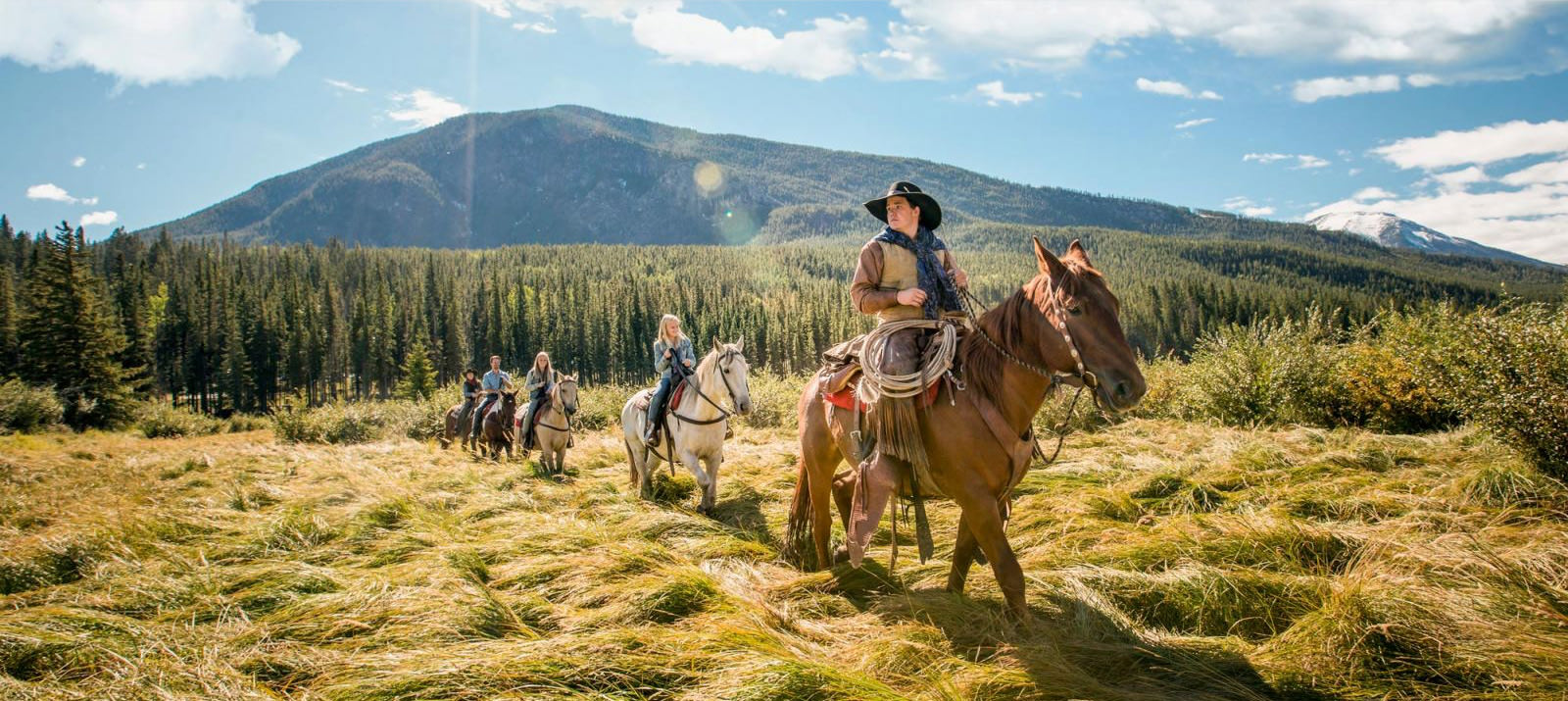
You’re heading out on the first section of your Grand Adventure - the northern section of the Cowboy Trail. Getting started you will head north from Calgary to Sundre, which is a good jumping-off point for wilderness trips or horseback adventures into the Rocky Mountain Forest Reserve. Or, just poke around Sundre's Pioneer Museum.
From here, you'll continue north to Rocky Mountain House to discover a superb National Historic Site where the story of Canada's fur trade and rugged voyageur life is re-enacted. For a different perspective take a Voyageur Canoe trip down the North Saskatchewan River. So wild is this forested area that when you spot the teepees and smell the smoke from the site's camp, you'll be spirited back 200 years when the trading post was first built.
Rocky Mountain House may be a good choice for an overnight stop or, if you'd rather continue on your journey, following the eastern flanks of the foothills, you will continue up Highway 22 to Mayerthorpe and set up camp at this northern terminus of the Cowboy Trail.
CanaDream Club Partners
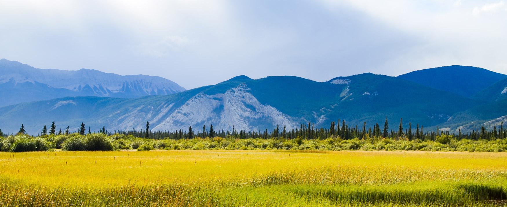
Leaving Mayerthorpe, you will continue to enjoy gorgeous countryside on your trip to Jasper. You’ll come across Edson, a town built in 1910 that is an important stop on the CN line today. Summer events here include a rodeo and a two-day sidewalk jamboree featuring street dancing, bands, auctions, and art and craft displays.
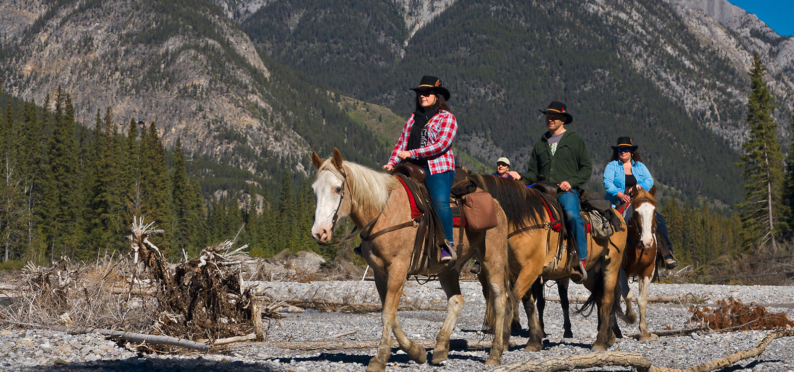
Continuing along Highway 16, you will come to Hinton. Hikers and horseback riders can explore a 20-kilometre restored section of the Bighorn Trail.
About 7 kilometres (4 miles) past Hinton, you can turn North on Highway 40 for about 22 kilometres (13 miles) and reach William A Switzer Provincial Park. Five lakes, linked by Jarvis Creek, provide more than 30 kilometres of canoeing through this park in the foothills of the Rockies.
Returning to Highway 16, you will continue on to Jasper National Park and the town of Jasper. Jasper National Park is a sweeping expanse of scenic beauty - of awesome mountain peaks and centuries-old glacial ice, of flower-carpeted meadows and mirror-like lakes. Enjoy and play during your time here.
CanaDream Club Partners
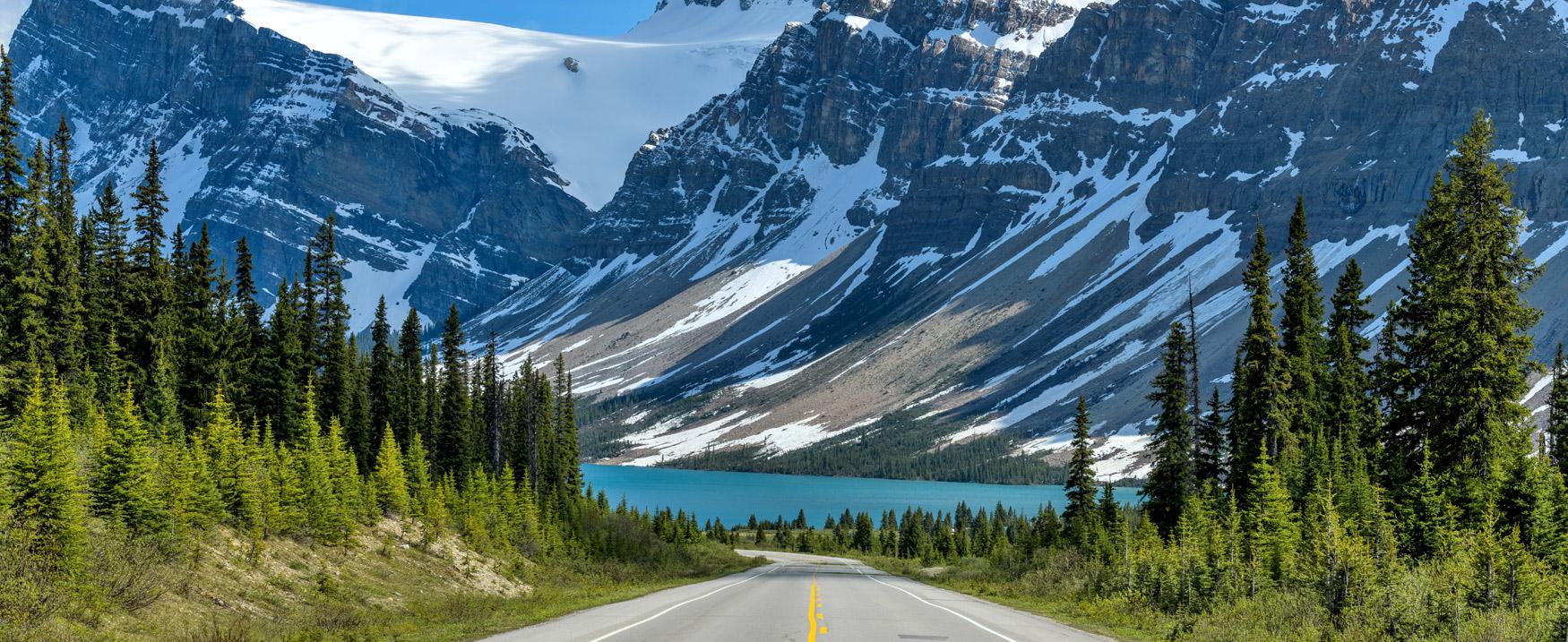
The 230-kilometre Icefields Parkway, running between Jasper and Lake Louise, ranks among the great highroads of the world and commands some of the most majestic scenery in the Canadian Rockies. The Parkway follows the Bow, Mistaya, North Saskatchewan, Sunwapta and Athabasca rivers, crossing the Bow and Sunwapta passes and presenting a panorama of peaks, glaciers, waterfalls and canyons.
Once part of the vast ice sheet that covered most of Canada for more than a million years, the Columbia Icefield is the largest accumulation of ice in the Rocky Mountains. It blankets an area of nearly 300 square kilometres to depths of 900 metres. The most accessible of the many glaciers that jut from the main body of the icefield is the Athabasca Glacier, which can be reached from the Icefields Parkway. Tours on the glacier give visitors a close look at mill holes (deep, circular depressions) and crevasses (long, nearly vertical fissures).
Keep your eyes peeled for Bow Summit, which at 2,068 m (6,785 ft.) above sea level, is the highest point on the parkway and offers one of the best mountain panoramas in the world at Peyto Lake viewpoint. Johnston Canyon and Vermillion Lake, closer to Banff, are great places to stop and snap some photos.
The Icefield Parkway ends in the picturesque village of Lake Louise. Continue east along the highway and you will soon enter the town of Banff, which is a year-round recreation center for tourists, horseback riders, skiers, hikers and mountain climbers.
Banff is the headquarters for the Banff National Park, which is the first and most famous of Canada's national parks with an incomparable combination of towering peaks and high meadows, emerald lakes and keen mountain air.
A must-visit is Sulphur Mountain, one of Banff's most popular attractions is the Banff Gondola here. The ride offers a sweeping panorama of mountains and valleys. If you’d like to brush up on some history, head to Banff Natural History Museum where specimens of wildlife native to Banff National Park are displayed. And, at Luxton Museum, First Nations lore and customs are shown in dioramas at the museum, which is built to resemble a 19th-century fur-trade post.
If you're looking for something to do in the evening, a stroll through Banff's downtown area is a good idea, as the shops are open late and restaurants are plentiful. The Parks Canada campground at Tunnel Mountain is the most convenient campground to use as a base for exploring Banff.
CanaDream Club Partners
- Columbia Icefield Glacier Adventure
- Glacier Skywalk
- Lake Louise Sightseeing Lift and Gondola
- Banff Gondola
- Upper Shunda Creek Campground
- Rockies Heli Canada
- Ski Marmot Basin
- Jasper SkyTram
- Alberta Food Tours
- Cave and Basin National Historic Site
- Banff Jasper Collection by Pursuit
- Moraine Lake Bus Company
- Girth-Hitch-Guiding
- Canadian Rockies Hot Springs
Leaving Banff you will head back to the Cowboy Trail passing through Kananaskis Country via highway 40. This area offers a mixture of year round activities.
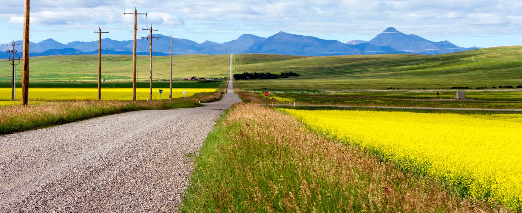
Once at Longview, explore the area and search out the towns of Millarville (famous for its farmers market held on Saturdays throughout the summer), Turner Valley (it was here, in 1914, that Canada's first major crude-oil discovery was made), Black Diamond and Longview. These towns are all part of Diamond Valley - the Heart of the Cowboy Trail.
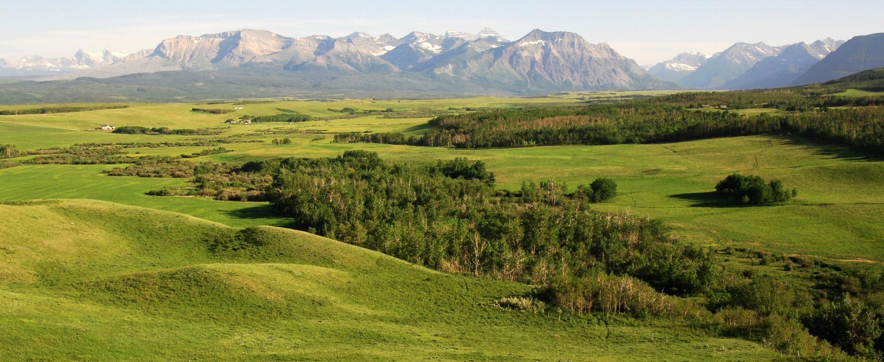
Just south of Longview is another excellent interpretive centre, the Bar U Ranch, full of original buildings, ongoing archaeological digs and intriguing exhibits. From here, head south, bound for Pincher Creek and continue south on Highway 6 to Waterton Lakes National Park, full of charming B&Bs, lodges, hotels and natural mountain splendour.
CanaDream Club Partners
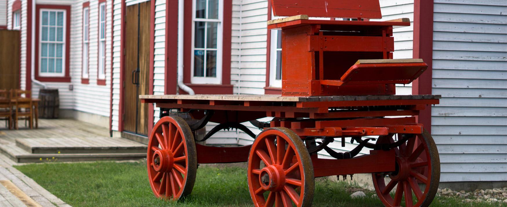
The Cowboy Trail ends at Cardston where the Remington-Alberta Carriage Centre is the number one attraction. Housing one of North America's largest collections of carriages, buggies and wagons, it's a spectacular example of another era ... the Wild, Wild West.
From summer markets to ranches and riding trails, explore and enjoy the rolling foothills of Alberta. As you are only a short distance from Waterton, you could also stay in Waterton an extra night and travel through Cardston on your return drive to Calgary tomorrow.
CanaDream Club Partners
From Cardston, head north on Highway 3 to Fort Macleod, the first outpost established by the North West Mounted Police (later RCMP) in 1874. Today Fort Macleod's top attractions include the downtown historic district, the province's oldest operating theatre (the Empress), the Fort Museum and the nearby UNESCO site of Head-Smashed-In Buffalo Jump. This is the largest, oldest and best preserved of all bison jumps in the world.
Then turn north on Highway 2 en route to Calgary, where you can visit attractions like Heritage Park, the Calgary Zoo and the Glenbow Museum. For a spectacular 360 degree view of Calgary, visit the Calgary Tower and dare to walk on their glass floor. Camp overnight at Calgary West Campground on the western edge of the city.
CanaDream Club Partners
- Fort Museum of the Northwest Mounted Police - Fort Macleod, AB
- Calgary Tower
- Calgary Walks & Bus Tours
- Heritage Park Historical Village
- Riverbend Campground Okotoks
- TELUS Spark
- Sandman Hotel Calgary
- Save-on-Foods, Calgary
- Days Inn Calgary North Balzac
- Comfort Inn & Suites Airdrie
- Wintergreen Golf & Country Club


